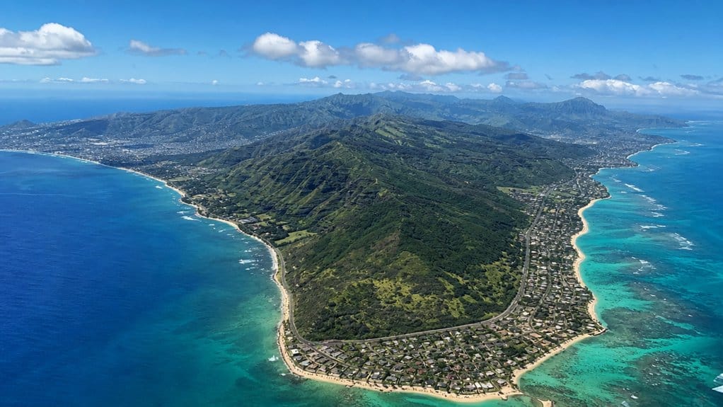
You might not know that Oʻahu is only about 44 miles long, or 71 kilometers, from east to west, which is why a cross-island day trip feels surprisingly doable. At its widest point, it stretches about 30 miles, or 48 kilometers, north to south, yet the shoreline twists for roughly 227 miles past surf breaks, sea cliffs, and quiet coves. That contrast changes how you plan your time, and the next details make it even clearer.
Key Takeaways
- Oʻahu is about 44 miles long from east to west, which is roughly 71 kilometers.
- At its broadest point, Oʻahu is about 30 miles wide, or around 48 kilometers north to south.
- Oʻahu covers about 596.7 square miles, equal to roughly 1,545.4 square kilometers.
- The island’s coastline is much longer than its length, stretching about 227 miles or 365 kilometers.
- Driving across Oʻahu’s 44-mile length usually takes 1 to 1.5 hours without traffic.
How Long Is Oahu From End to End?
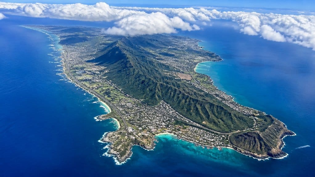
How long is Oʻahu from end to end? If you picture the island stretched from east to west, you’re looking at about 44 miles, or 71 km. That gives you a handy sense of scale before you set out. These Oahu dimensions are commonly used to describe the island’s overall size.
On the road, that distance feels surprisingly manageable. You can leave one side of Oʻahu with salt on your skin and reach the other after a drive that threads past ridges, neighborhoods, and flashes of blue water. Families planning a full day out often pair a cross-island drive with Waikiki transportation to attractions like Wet ‘n’ Wild Waterpark. For planning, 71 km works well as a simple one-way estimate. The number comes from Oʻahu’s overall dimensions, which help explain how the island packs beaches, towns, and mountain backdrops into a compact space. It’s long enough for a real cross-island outing, but short enough that your playlist probably won’t even finish. Looking at an Oahu map can also help you picture how the island’s regions, beaches, and scenic driving loop fit within that compact length.
How Wide Is Oahu at Its Broadest Point?
If Oʻahu’s 44-mile length gives you the island’s runway, its width shows you its sturdy, compact shape. At its broadest north to south, you’re looking at about 48 km (30 miles). That means Oʻahu feels broad without feeling oversized, almost like a well-packed travel bag with beaches. It also means you’re within reach of swim spots, snorkeling coves, and surf breaks across the island.
You can picture that width by tracing from the North Shore down toward Honolulu and the Windward Side of Oahu, with the Waiʻanae and Koʻolau ranges helping shape the island’s broad span. Those ridges frame valleys, roads, and neighborhoods, so the distance feels varied rather than flat. Along that span, you’re also never too far from some of the island’s best beaches, whether you’re after swimming, snorkeling, or sunset views. Compared with its east to west reach, Oʻahu is roughly half as wide as it is long. Even its 596.7 square miles suggest a compact footprint, not a stretched-out island at all. Travelers often ask How Wide Is Oahu when comparing its compact shape to Hawaiʻi’s larger islands.
How Big Is Oahu in Acres and Square Miles?
When you look at Oʻahu as a whole, you’re looking at about 596.7 square miles, or roughly 597 in most quick references, which equals about 382,050 acres. That number feels bigger when you picture an island stretching about 44 miles east to west and 30 miles north to south, with 227 miles of coastline curling around beaches, cliffs, and harbors. If you’re trying to grasp its footprint, square miles give you the big map view, while acres make the size feel a bit more real. Its size also helps explain why visitors often choose different base areas like Waikiki and Kailua, depending on whether they want city energy or a more laid-back stay.
Still comparing Oahu Geography, Language, And Visitor Basics?
Ask for tour ideas, hotel suggestions, or a simple trip plan that combines both.
Trip Helper
Oʻahu Area Overview
Though Oʻahu often feels easy to cross on a map, the island covers about 596.7 square miles, or roughly 1,545.4 square kilometers, which works out to around 381,000 acres of land. That gives you a better sense of the island of Oʻahu and its Land Area within the United States. First-time visitors comparing Oahu attraction passes often use the island’s overall size to decide how many sights they can realistically fit into one trip. You can drive across broad valleys, climb ridges, and still underestimate its scale until the road bends again.
| Measure | Imperial | Metric |
|---|---|---|
| Land area | 596.7 sq mi | 1,545.4 km² |
| Footprint | 381,000 acres | 227-mile coast |
From tip to tip, you’re looking at about 44 miles east to west and 30 miles north to south. Add 227 miles of shoreline, and Oʻahu stops feeling small fast. Beaches, cliffs, and neighborhoods keep unfolding around every curve.
Square Miles To Acres
On paper, Oʻahu covers about 596.7 square miles, and that works out to roughly 381,888 acres, or about 381,900 acres once you round it.
If you want a quick way to picture the island of Oahu, converting square miles into acres helps a lot. You’re not measuring length here. You’re measuring area.
- Start with 596.7 square miles.
- Multiply by 640 acres per square mile.
- You get 381,888 acres.
- Round it and you have about 381,900 acres.
That simple math gives you a cleaner sense of scale. Oʻahu may stretch about 44 miles east to west and 30 miles north to south, but those numbers don’t create the acreage total. Area does. For size comparisons, acres make the island feel more graspable and much less abstract. Honolulu, the island’s urban core, is one of the 7 key things many travelers learn first when getting familiar with Oʻahu. Visitors planning lodging costs should also know Hawaii’s Green Fee begins Jan. 1, 2026, adding 0.75% to the state transient accommodations tax. It’s one of several Oahu travel tips that can help first-time visitors better understand the island before they go.
Land Size Context
Even if Oʻahu feels endless once you’re driving its coasts and neighborhoods, the island’s land area is about 596.7 square miles, or 1,545.4 square kilometers. That works out to roughly 381,900 acres, which gives you a clearer sense of how much ground you’re actually covering between surf towns, ridges, and city blocks. Popular coastal activities like parasailing in Waikiki can make the island feel even more expansive from above.
You can picture that footprint through Oʻahu’s shape too. It stretches about 44 miles east to west and 30 miles north to south. That makes it the 20th-largest island in the United States, though not Hawaii’s largest island. Places on Oʻahu include Waikīkī, windward beaches, and the harbor that anchors the Pacific Fleet. Its 227 miles of shoreline may grab your attention first, but land area tells you how big the island really feels under your feet. On the same island, experiences like the Mauka Warriors Luau add another layer to how visitors connect with Oʻahu beyond its raw size. For another way to experience a small part of that landscape, an Electric Bike Ride and Manoa Falls hike tour combines road and trail exploration on Oʻahu.
Why Oahu’s Shoreline Is Much Longer Than Its Length
When you hear that Oʻahu is about 44 miles long, you might picture a simple shape, but the coast refuses to behave that neatly. You see the difference when bays, coves, and inlets like Kāneʻohe Bay and Pearl Harbor keep bending the shoreline around cliffs, beaches, and harbors. That’s why the shoreline stretches to about 227 miles, because you’re measuring how the island wraps around the sea, not just its longest straight line. Small-group travelers often notice this variety most clearly on a Circle Island Tour, where waterfalls, temple stops, and local towns reveal how much the coastline changes from one region to the next. This varied coast also helps explain why Oahu snorkeling spots range so widely by skill level, from calmer protected areas to more challenging open-water shores. Travelers comparing coastal attractions often look at Sea Life Park Oahu tickets alongside nearby beach and marine activity plans.
Irregular Coastal Shape
Although Oʻahu measures only about 44 miles (71 km) from east to west, its shoreline runs roughly 227 miles (365 km) because the island’s edge twists, curves, and doubles back instead of tracing a neat outline.
You notice that irregular coastal shape almost immediately, even around Waikiki, where the coast bends instead of running straight. Nearby, Waikiki beaches and walkable shoreline spots make those coastal curves especially easy to notice on foot. On a Waikiki Beach map, it becomes even clearer how swimming areas, surf zones, and shaded stretches follow the shoreline’s bends rather than a straight coastal line. That’s why the perimeter feels so long compared with the island’s size.
- You can drive a short distance and watch the shore swing from broad sand to rocky points.
- The windward and leeward sides keep folding into different contours.
- Oʻahu’s volcanic ridges and central saddle helped carve those turns.
- Even with a north to south span near 30 miles, the coast stretches about five times the island’s length.
It’s geography with extra mileage built in. In April in Honolulu, those shifting coastal curves also shape where visitors spend their time, from beaches to scenic shoreline walks.
Bays, Coves, And Inlets
Often, the real reason Oʻahu’s shoreline stretches so far comes down to all the bays, coves, and inlets that notch the island’s edge. When you trace the coast, you don’t get a neat outline. You get curve after curve, pocket after pocket, with water folding into the land.
Kāneʻohe Bay shows this perfectly on the windward side, where rain feeds lush valleys and the coast breaks into sheltered bends. Visitors without a rental car can still reach this area through Kaneohe sandbar tours that include transportation. Its famous sandbar tours also highlight how broad, shallow, and irregular this part of the bay is. You also find smaller coves along the North Shore and leeward coast, each one adding distance that a simple glance misses. Hanauma Bay, protected as a Marine Life Conservation District since 1967, is another example of how an inlet can carve deeply into Oʻahu’s coastline. The Koʻolau and Waiʻanae ranges push ridges toward the sea, so the shoreline twists instead of running straight. That’s why Oʻahu measures about 227 miles around the coast, even though the island itself feels far shorter on a map at first glance.
Shoreline Versus Island Length
The big surprise is that Oʻahu’s length and its shoreline measure two completely different things. When you look at a map, you might expect the United States’ largest Hawaiian population center to be simple. It isn’t.
- Oʻahu stretches about 44 miles east to west, but only about 30 miles north to south.
- Its shoreline runs roughly 227 miles, or 365 kilometers, around the coast.
- That total includes every bend, bay, and curve carved by the island’s volcanic shape.
- Places like Waikīkī, Pearl Harbor, and Kāneʻohe Bay add miles with each inward scoop.
- Visitors tracing the coast often compare TheBus, driving, or tours when deciding how to explore different parts of the island.
- Coastal areas on Oʻahu can also vary widely in conditions, so tide pool safety matters when exploring sections of the shoreline.
- At spots like Sans Souci, calm-day conditions can make shoreline entry easier for snorkelers.
Where Is Oahu Located in Hawaii?
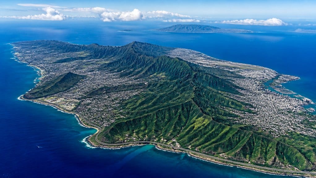
Out in the central Pacific, Oʻahu sits near 21.5°N, 158.0°W and holds a prime spot in the Hawaiian chain. When you look at a map, you’ll find it between Kauaʻi to the northwest and Molokaʻi to the southeast. The Kauaʻi Channel and Kāiwī Channel separate those neighbors. For travelers exploring the island, Lanikai sunset spots on the windward side are especially known for beautiful evening light.
You’ll also notice that Oʻahu belongs entirely to Honolulu County, formally the City and County of Honolulu. Understanding the difference between Oahu and Honolulu helps here, since Honolulu is the capital city on the island rather than a separate island itself. That means Honolulu, the state capital, anchors the island’s southeast coast. Visitors arriving through Honolulu can use several HNL to Waikiki transportation options to reach the resort area quickly. You’re in the central Pacific Ocean here, but the island feels surprisingly connected, with busy harbors, surf-beaten shores, and mountain ridges rising behind town. Oʻahu stretches about 44 miles east to west and 30 miles north to south, so you get a compact island with a big presence and plenty of coastline to explore.
How Long Does It Take to Drive Across Oahu?
How long does it take to drive across Oʻahu? If you drive the island’s longest east to west stretch, you’ll cover about 44 miles and usually need 1 to 1.5 hours without traffic. In real life, though, you’ll often spend 2 to 3 hours once Honolulu slowdowns and quick stops join the ride.
- Start near Waikiki and city traffic can thicken fast.
- Pass Pearl Harbor and the roads may briefly open up.
- Head toward the North Shore and beach detours add time.
- Drive north to south instead, about 30 miles, and you might need 45 minutes to 1.5 hours.
If you’d rather skip navigating altogether, several easy pickup options make it simple to explore Oʻahu without a rental car.
November often brings milder weather in Honolulu, which can make longer island drives more comfortable. For travelers continuing beyond the cross-island drive, the route to Waimea Falls from Waikiki is often one of the easiest scenic options to follow. You’re not crossing a huge island, but Oʻahu likes to stretch time with scenic bays, red brake lights, and one more tempting lookout on the route.
How Long Does It Take to Drive Around Oahu?
Around Oʻahu, a practical loop near the island’s main coastal roads usually covers about 120 to 150 miles, and if you keep moving, you can finish it in roughly 4 to 6 hours. That estimate fits a near-perimeter route, not every curve of the shoreline. If you start near Waikiki beach, circle past Koko Head and Hanauma Bay, then continue through the Windward side and North Shore, you’ll cover plenty of ground fast. This kind of circle drive works best when you treat it as a practical coastal loop rather than a strict edge-to-edge island lap.
Most travelers won’t treat it like a stopwatch run. You’ll probably want beach stops, lookout pauses, and time in small towns, so a full day of 8 to 10 hours feels more realistic. A car gives you the easiest timing and freedom. You can use TheBus, but transfers stretch the loop, and your island circuit suddenly feels much longer than planned. If you add a stop for the Diamond Head hike, expect extra time since hike length and timing there are best planned with realistic estimates.
Why Oahu Takes Longer to Cross Than Expected
You might see Oʻahu’s 44-mile width and expect a quick cross-island drive, but the Waiʻanae and Koʻolau ranges push you onto curved roads instead of a clean straight shot. You often follow coastal highways, pass through Honolulu traffic, and thread across busy neighborhoods where a short distance can feel surprisingly slow. Add warm rain and slick pavement, and you’ll hear the island reminding you that miles on a map don’t tell the whole story. Similar trade-offs appear at Diamond Head, where access rules and limited vehicle entry can make a short drive feel less convenient than expected.
Mountain Range Barriers
Although Oʻahu looks fairly compact on paper at about 44 miles east to west and roughly 30 miles north to south, its two big mountain ranges make the island feel much wider when you’re actually on the road.
You’re dealing with the Waiʻanae and Koʻolau, which shape nearly every cross-island trip in the County of Honolulu. Instead of driving straight, you weave through passes or swing around the interior. That’s why a short map distance can feel surprisingly long.
- The central valley funnels you into limited routes.
- Windward trips mean dropping down the Koʻolau side.
- Leeward drives bend around the Waiʻanae barrier.
- Even quick plans for water activities can take extra time.
From Honolulu or Waikīkī, those green ridges look beautiful and innocent. Then your route says otherwise. Mountains don’t argue, and neither does your odometer.
Coastal Roads And Traffic
On Oʻahu, the map can fool you fast. You might see a compact island, then realize it stretches about 44 miles east to west and 30 miles north to south. Those numbers grow once your route hugs the coast instead of slicing straight inland.
Most major roads bend around the Koʻolau and Waiʻanae ranges, so you trace shorelines, towns, and scenic pullouts. A drive past Kailua Bay can feel easy, then the miles quietly stack up. Near Honolulu, traffic thickens around the island’s busiest hub, where the deepwater port and dense streets shape the City and County’s daily flow. Add in plans that link the North Shore, Windward side, and Leeward coast, and a same island outing suddenly covers serious ground along 227 miles of shoreline.
Short Distance Slow Travel
That compact outline on the map doesn’t prepare you for how slowly Oʻahu can unfold in real life. You see just 44 miles across and 30 miles top to bottom, yet the Hawaiian Islands teach scale differently, especially here.
- You don’t drive straight. The Waiʻanae and Koʻolau ranges bend roads around ridges and through passes.
- You chase destinations. Honolulu, Waikīkī, Pearl Harbor, the North Shore, and the eastern (windward) coast pull you in different directions.
- You feel traffic. Coastal routes look easy on a map, then brake lights bloom like a red lei.
- You travel better slowly. Give yourself five days, listen for surf, notice traditional Hawaiian place names, and let the central plateau, sea cliffs, and roadside fruit stands reset your sense of distance.
What Are Oahu’s Main Regions?
Where should you start when people talk about Oʻahu like it’s several islands in one? You can think of four main regions that locals use for wayfinding. The City/Town/Town side runs from Halawa to below Diamond Head. It’s the busy urban stretch where streets hum, high-rises catch the sun, and neighborhoods flow into Honolulu.
Head west and you’re in West Oʻahu, often called Leeward. This area usually means Pearl Harbor through Kapolei and Ewa, and some people stretch it farther to Makaha and Waiʻanae. The North Shore covers the northwestern coast, with famous breaks like Banzai Pipeline and Sunset Beach. The Windward Side / East Side includes the northeastern coast and places east of Diamond Head, where green cliffs, trade winds, and blue bays make the scenery feel almost suspiciously perfect.
What Are Typical Drive Times Between Oahu Regions?
Even though Oʻahu looks compact on a map, drive times can stretch fast once traffic joins the conversation. You can cross regions fairly quickly off-peak, then watch the same route double when everyone else has the same idea. Head out early if you want calmer roads and fewer brake lights.
On Oʻahu, short distances can turn long fast once traffic shows up, so early starts usually win.
- Waikīkī to Pearl Harbor or Kapolei usually takes 30 to 45 minutes.
- Waikīkī to the North Shore often runs 1.5 to 2.5 hours.
- Honolulu to Kaneohe Bay, Kailua, or Lanikai is often 45 to 90 minutes.
- Waikīkī to Ko Olina takes about 30 to 60 minutes, while farther west can hit 60 to 120 plus.
That spread matters. On Oʻahu, traffic is the real clock, and it can add 30 to 60 extra minutes easily.
What Are the Best Scenic Drives on Oahu?
If traffic sets the pace on Oʻahu, the scenery makes the trip worth it. Start with the Kaʻala–Koolau viewpoints drive and aim mauka toward Kaʻala, Oʻahu’s highest peak in the Waiʻanae Range. You’ll trade city edges for broad skyline views and a real sense of the island’s shape.
Then head makai on the Windward side toward Kāneʻohe Bay, where the Kōolau mountains rise in sharp green folds above the coast. Overlooks reveal blue water, cliff shadows, and roads that seem to curl right into the landscape. For surf energy, take the North Shore scenic highway past Banzai Pipeline and Sunset Beach. Pull over when you can. The shoreline feels rougher, saltier, and a little louder. If you want contrast, cruise west to Ko Olina’s calmer coves too.
How Oahu Compares With Maui and Kauai
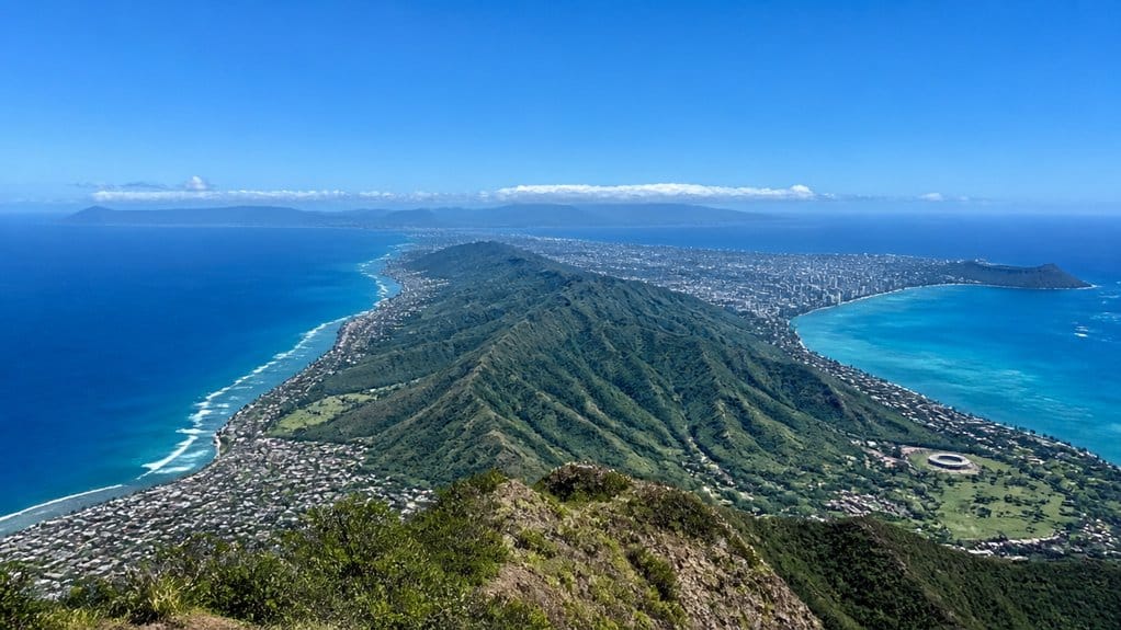
While Oʻahu stretches about 44 miles east to west and roughly 30 miles north to south, its shape and feel set it apart from both Maui and Kauaʻi. You’ll notice Oʻahu isn’t the largest of the Hawaiian islands by area, though some visitors assume it’s the largest of the Hawaiian because Honolulu feels so big and busy.
- Length: Maui runs about 48 miles, so it’s slightly longer than Oʻahu. Kauaʻi reaches about 33 miles.
- Area: Oʻahu covers 596.7 square miles. Maui is larger. Kauaʻi is a bit smaller.
- Shoreline: Oʻahu gives you about 227 miles of coast, plenty for beaches, cliffs, and surf noise.
- Landscape: Two old shield-volcano ranges frame Oʻahu, creating a central valley and a more concentrated island rhythm than Maui or Kauaʻi.
How Many Days to Spend on Oahu
For a first trip to Oʻahu, give yourself at least 5 days so you can see the island’s big highlights without turning the whole vacation into a race.
| Trip style | Best length |
|---|---|
| Waikīkī only | 2 to 3 days |
| First highlights | 5 days |
| Nature and culture | 7+ days |
| City + outdoors | 6 to 8 days |
If you stick to Honolulu and Waikīkī, a few days works. You can shop, hit the beach, and hike Diamond Head. If you want the full Gathering Place feel, stay longer. Give yourself time for the North Shore, Kāneʻohe Bay, and Lanikai Beach. You’ll also move smarter if you focus on one region at a time. Try Waikīkī and Pearl Harbor first. Then head north. Save Kailua for another day. Your schedule will feel fuller, not frantic.
Frequently Asked Questions
What Is the Population Density of Oahu?
You’ll find Oʻahu’s population density is about 1,703 people per square mile, or 658 per km². You can link that crowding to economy diversity, beach tourism, and housing affordability pressures around Honolulu.
Which Month Has the Best Weather on Oahu?
June gives you Oʻahu’s best weather: warm temperatures, lighter rain, invigorating Trade Winds, and excellent ocean swimming. You’ll usually avoid winter storms then, while still enjoying sunny beaches and comfortable island conditions throughout most days.
Are There Inter-Island Ferries From Oahu?
Yes, you’ll find limited Inter island ferry options from Oʻahu, not widespread service. Use a ferry routes overview and confirm current schedules. If you’re traveling to Maui, you’ll usually book flights instead of ferries.
What Is the Highest Point on Oahu?
Oʻahu’s highest point is Kaʻala, about 4,003–4,025 feet high. Like a crown above sleeping giants, you’ll find its Summit elevation in the Waiʻanae Range, surpassing Koolau Range peaks despite Mauna Kea influence elsewhere statewide.
Is Oahu Larger Than the Big Island?
No, you can’t say Oʻahu is larger. In this Island size comparison, Big Island metrics clearly win. You’ll see Land area contrasts: Oʻahu has about 597 square miles, while Hawaiʻi Island is far bigger overall.
Conclusion
Now you know Oʻahu isn’t huge, but it isn’t tiny either. You can cross about 44 miles end to end, yet the shoreline keeps curling for 227 miles, like a ribbon that won’t sit still. That’s why a short drive can still feel full of surprises. You’ll hear surf at one stop, see cliffs at the next, and reach town before sunset. Pack a map, start early, and let the island stretch your sense of distance.