
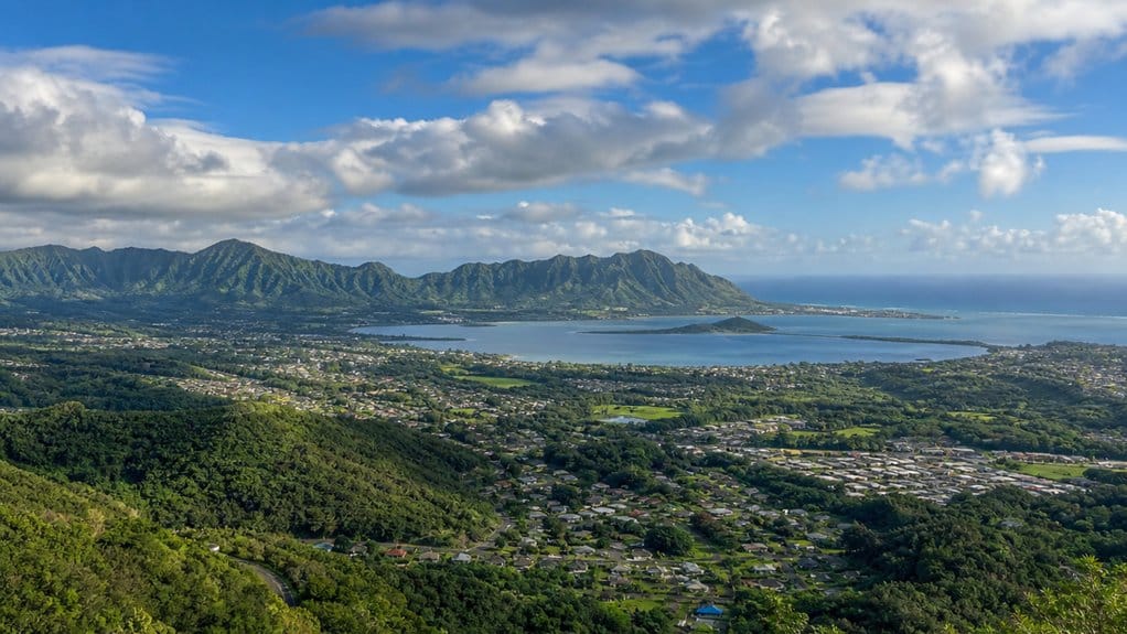
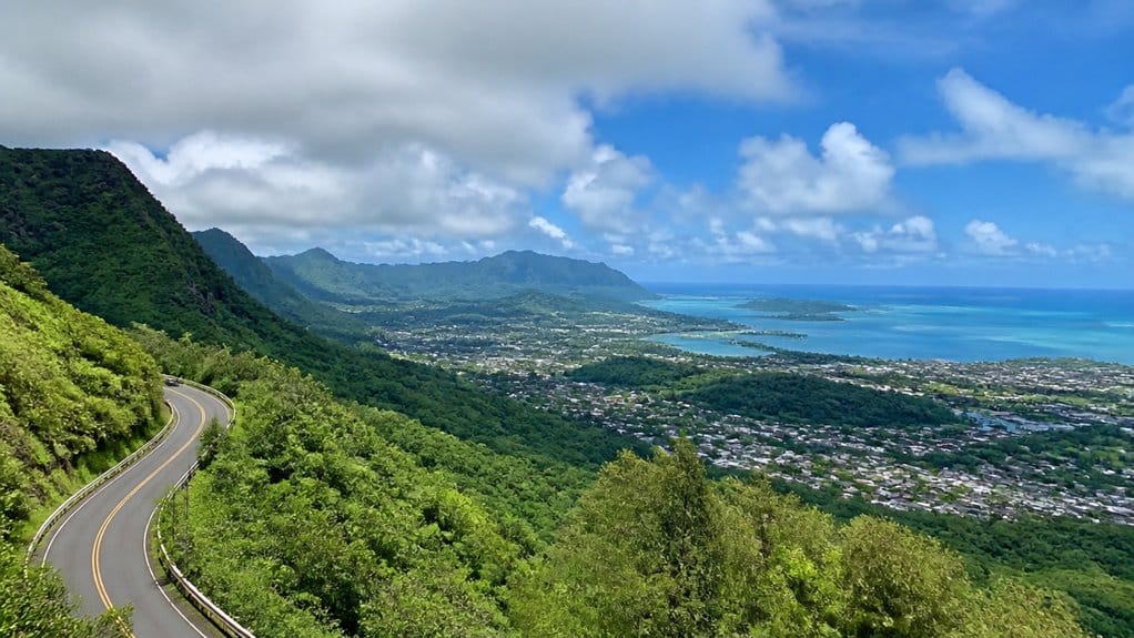
If you’re wondering where Kāneʻohe sits on Oʻahu, look to the island’s windward side about 12 miles northeast of Honolulu. You’ll find it between the green Koʻolau foothills and the calm spread of Kāneʻohe Bay, where neighborhoods slope gently toward the shore. It feels tucked between mountain mist and salt air, with easy access to Kailua and town. That location shapes almost everything about Kāneʻohe, and there’s more to notice than the map first shows.
Key Takeaways
- Kāneʻohe is on Oʻahu’s windward side, about 12 miles northeast of Honolulu.
- It sits between the Koʻolau Range foothills and the shoreline of Kāneʻohe Bay.
- Kāneʻohe is part of the City and County of Honolulu, though it feels separate from urban Honolulu.
- The town faces Kāneʻohe Bay rather than the Honolulu skyline and is mostly residential.
- You can reach Kāneʻohe from Honolulu by routes including Likelike Highway, H-3, and Kamehameha Highway.
Where Is Kāneʻohe on Oʻahu?

On Oʻahu’s windward side, Kāneʻohe sits about 12 miles northeast of Honolulu, tucked between the green foothills of the Koʻolau Range and the calm waters of Kāneʻohe Bay. You’ll find it on the island of Oahu in the City and County of Honolulu, facing the bay instead of the city skyline. The setting feels lush and open, with steep ridges behind you and broad water in front. Travelers heading toward nearby offshore spots often start here before making the short trip to Secret Island Kaneohe.
As you move through town, the commercial center follows Kamehameha Highway, where shops and daily life stretch in a practical line. Kāneʻohe covers about 8.46 square miles, including both land and water, so the bay is always part of the picture. Around Heʻeia Kea, a public pier and boat ramp put you close to the water, where boats bob and trade winds keep things lively nearby. Visitors without a rental car can still book Kaneohe Sandbar tours that depart from this area and make the bay easy to experience. Many visitors use this side of the coast as a starting point for sandbar tours that explore the shallow waters of Kāneʻohe Bay.
How Far Is Kāneʻohe From Honolulu?
From downtown Honolulu, Kāneʻohe sits about 12 miles to the northeast, which sounds close because it is. If you’re looking at a map, you’ll notice that short distance puts you well beyond the city center without feeling far removed. The coordinates place Kāneʻohe clearly northeast of Honolulu, so you can picture it as a quick hop rather than a major journey. It also serves as a convenient starting point for exploring the Windward Coast and nearby attractions like Kualoa and the sandbar. Many visitors choose the area as a base for sandbar tours that depart into Kaneohe Bay.
Recommended hotels for this trip
Compare well-reviewed stays from our destination hotel guides, then check live availability for your dates.
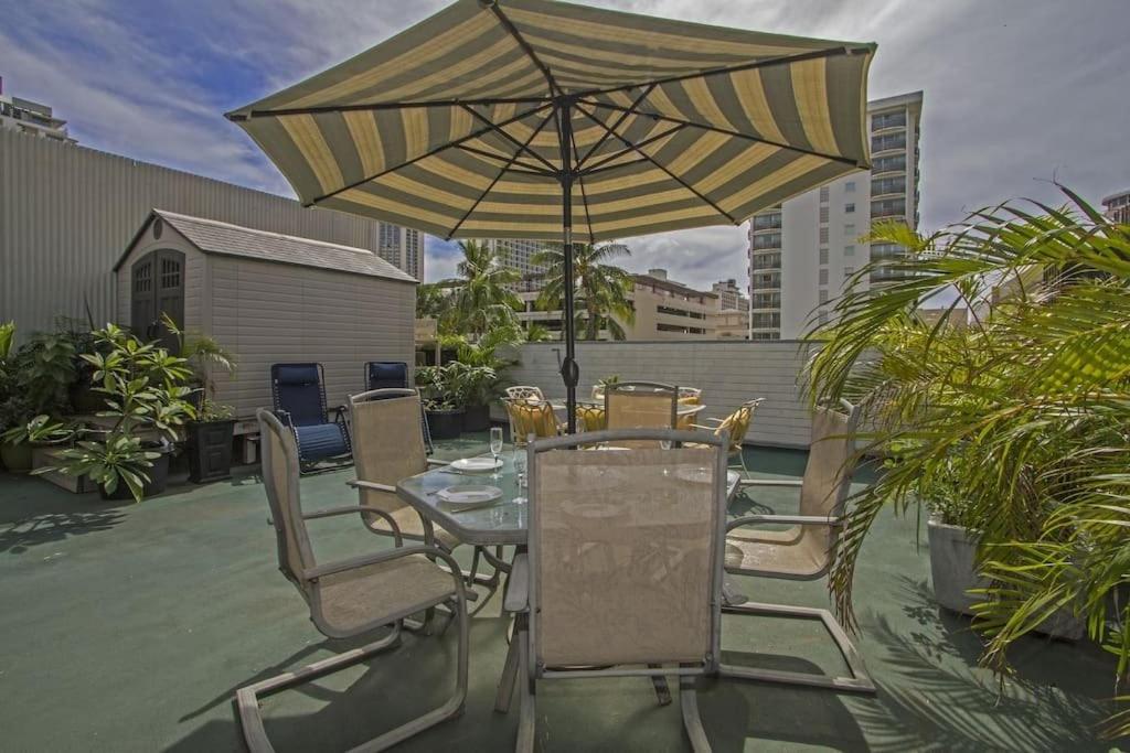 Featured stay
 Hawaiian King
- Free WiFi
- Non-smoking rooms
- Air conditioning
Luxurious Accommodation with Stunning Views Nestled in the vibrant Waikiki district of Honolulu, Royal Waikiki Penthouses boasts a range of upscale amenities for a memorable stay. Each unit offers a private entrance, air conditioning, and a…
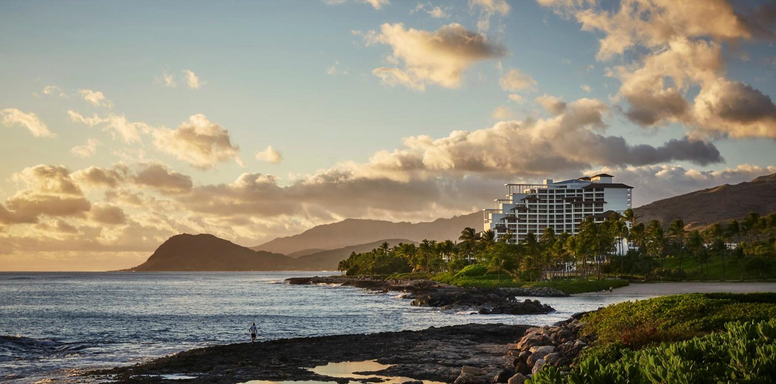 Guest favorite
 Four Seasons Resort Oahu at Ko Olina
- Free WiFi
- Non-smoking rooms
- Air conditioning
Luxurious Hawaiian Beach Resort Exquisite Accommodations Indulge in luxury with a 65-inch HDTV, a deep soaking tub, and a walk-in glass shower in every guest room at Four Seasons Resort Oahu at Ko Olina. Enjoy the…
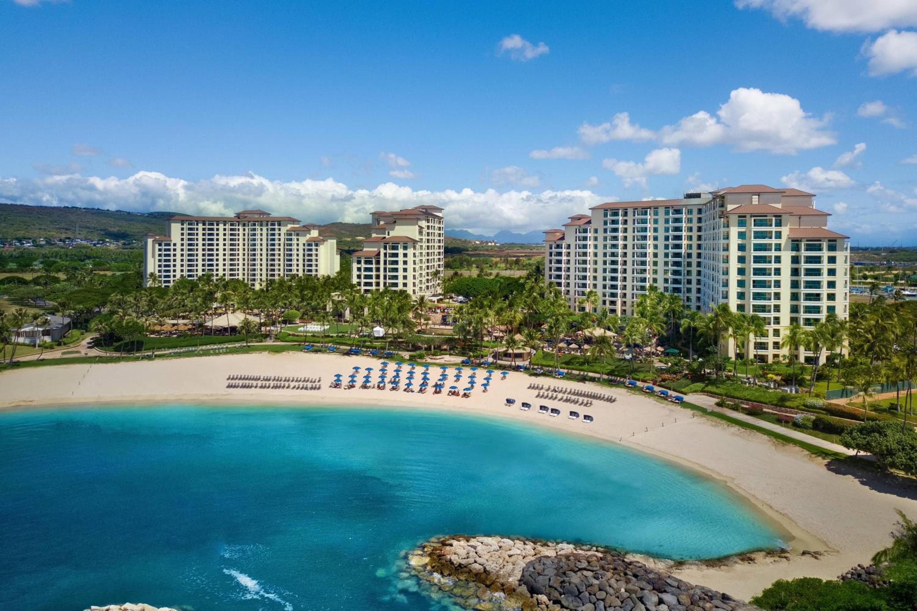 Guest favorite
 Marriott's Ko Olina Beach Club
- Free WiFi
- Non-smoking rooms
- Air conditioning
Luxurious Accommodations The Marriott's Ko Olina Beach Club offers spacious rooms with stunning ocean or mountain views, fully equipped kitchens, and modern amenities like a washing machine and dryer. Dining and Entertainment Indulge in American cuisine…
If you’re driving from Honolulu, especially from Waikīkī, you’ll usually reach the Kāneʻohe Bay area in about 30 minutes, depending on traffic. You can take Likelike Highway and connect toward Kamehameha Highway, following one of Oʻahu’s main cross-island routes. The trip feels practical and scenic at once. One moment you’re in town, and the next you’re tracing green ridges and catching hints of bay light ahead. Some travelers also get a broader sense of Oʻahu’s layout by booking Pearl Harbor views on helicopter routes that showcase the island from above.
Is Kāneʻohe on Oʻahu’s Windward Side?
Yes, you’ll find Kāneʻohe on Oʻahu’s windward side, where the Koʻolau foothills slide down to the calm blue sweep of Kāneʻohe Bay. The bay is also known for boat rentals that help visitors explore its calm waters and sandbars. As you head about 12 miles northeast from Honolulu, you’re right on the windward route, with green ridges, passing showers, and a landscape shaped by all that rain. Like Honolulu in February, this side of the island often sees passing showers that keep the scenery lush. You’ll also notice Kāneʻohe sits alongside Kailua as one of this side’s biggest residential communities, so it feels lived-in, local, and easy to place on the map. It’s also part of the Windward Coast area that includes nearby Kailua and Kualoa on this side of Oʻahu.
Still comparing Kaneohe Sandbar And Kaneohe Bay?
Ask for tour ideas, hotel suggestions, or a simple trip plan that combines both.
Trip Helper
Windward Side Position
Definitely, Kāneʻohe sits on Oʻahu’s windward, or northeastern, side, about 12 miles from Honolulu. If you picture the island, you’ll find this town facing the wetter, greener coast rather than the drier leeward side. That windward position shapes the feel right away.
As you explore Oʻahu, Kāneʻohe stands out as one of the windward side’s two biggest residential communities, along with Kailua. Visitors often pair time here with Windward Coast outings that highlight nearby beaches and kayak-friendly areas. You’re close enough for easy access when Honolulu operates as the island’s urban hub, yet the setting feels calmer and more local. The town stretches across a broad area, giving you a strong sense of neighborhood life instead of a compact resort zone. You’ll notice leafy streets, everyday shops, and steady trade winds that remind you you’re firmly on Oʻahu’s breezier side. By contrast, Oʻahu’s leeward coast is known for a drier climate and a different mix of beach stops and towns. It feels pleasantly unhurried too. For visitors planning island outings, the windward location also puts you within reach of easy transit access to popular snorkeling areas on Oʻahu.
Bay And Koʻolau Setting
Along Kāneʻohe’s edge, the land slides down from the green foothills of the Koʻolau Range to the calm spread of Kāneʻohe Bay, so you can see right away why this is Oʻahu’s windward side. It also makes Kāneʻohe a natural base for an Oahu Windward day trip along the island’s lush eastern coast.
When you look at a map, you’ll spot Kāneʻohe in Koʻolaupoko on Oʻahu’s east to northeast coast. The Kaneohe CDP stretches from mountain slopes toward the bay, and that layout shapes everything you see. Kāneʻohe Bay is huge by Hawaiʻi standards, about eight miles long and up to four kilometers wide, with a broad ocean-facing opening. The water stays sheltered, so the bay often looks glassy even when trade winds hustle overhead. Unlike Oʻahu’s North Shore Pipeline, Kāneʻohe Bay is known more for protected waters than for heavy surf conditions. You also notice how much water belongs to the Kaneohe CDP itself, which gives the area a distinctly coastal feel under those dramatic ridgelines. This setting also places the community close to several Windward stops and lookouts along Oʻahu’s east coast.
Nearby Windward Communities
From Kāneʻohe, you’re firmly on Oʻahu’s windward side, about 12 miles northeast of Honolulu where the Koʻolau foothills run down to the bay. You can feel that setting right away in the trade winds, the green ridges, and the quick access to water. On especially calm mornings, some windward outings also line up well with clear water days for ocean activities.
As you look around, you’re in one of Oʻahu’s two biggest windward residential communities, with Kailua as the other major neighbor. The commercial heart stretches along Kamehameha Highway, so errands, snacks, and local stops line your route. Nearby bay communities include Heʻeia and Heʻeia Kea, where you can reach Kāneʻohe Bay from the public pier and boat ramp. It’s a practical detail, but also a scenic one. Boats bob, palms flicker, and the bay usually looks like it’s showing off a little. Visitors staying here are also within easy reach of self-guided kayaking options in nearby Kailua. Kāneʻohe also sits close to Kailua kayaking spots and access into Kaneohe Bay, making it a convenient base for paddling on Oʻahu’s windward coast.
Where Is Kāneʻohe Bay Located?
You’ll find Kāneʻohe Bay on Oʻahu’s windward side, a broad sheltered stretch of water that runs about 8 miles long and holds bright reef flats, small islets, and calm blue channels. As you look out, you can spot places like Mokoliʻi and Coconut Island, and you’re seeing one of Hawaiʻi’s rare barrier-reef bays, which gives the shoreline a quieter, protected feel. Unlike areas such as Ko Olina or Waikiki, Kāneʻohe Bay is better known for its sheltered bay waters than for classic open-coast snorkeling spots. It’s also a popular launch point for sandbar boat rentals, with several top-rated options taking visitors out onto the bay. If you want to get onto the water, you’ll usually head to the public pier and boat ramp near Heʻeia Kea, where the day starts with trailers rolling and boats pushing off. For travelers also exploring nearby Kailua, self-guided Windward outings like paddleboard rentals are a popular way to experience more of Oʻahu’s windward coast.
Kāneʻohe Bay Setting
If you look to Oʻahu’s windward, or northeastern, side, you’ll find Kāneʻohe Bay spread out beside the town of Kāneʻohe as a broad sheltered sweep of water. Kāneʻohe Bay is located off this coast, stretching about 8 miles long and 2.7 miles wide, with a mouth nearly 4.6 miles across. You’re looking at one of Oʻahu’s most distinct marine settings. Oʻahu visitors who also want to explore marine life often look beyond the bay to snorkel spots known for turtle sightings around the island.
As you take in the bay, you’ll notice named features punctuating the water, including Mokoliʻi, Moku o Loʻe, and Kekepa. The bay stays fairly shallow, averaging about 8 meters, though the dredged channel reaches around 40 feet. Visitors exploring Oʻahu’s shoreline often combine scenic stops like this with a turtle beach snorkel experience on the island’s North Shore. Along the shoreline, fringing and breaking reefs shape the scene and stir up currents that can shift quickly from one small patch of water to the next, almost like the bay changing its mind. On Oʻahu’s windward side, changing trade winds and reef-influenced currents are also important wind tips for paddlers navigating nearby coastal waters.
Bay Access Points
Where do most people actually step into Kāneʻohe Bay? You’ll usually start at Heʻeia Kea, where the public pier and boat ramp give you the clearest, easiest launch near town. Kamehameha Highway runs northward through Kaneohe’s main commercial strip, so finding shoreline turnoffs feels simple. Parking can fill quickly near popular shoreline access, so checking best spots before you go helps avoid wasted time. From there, you can head toward beaches around Kaneohe and Heʻeia for sightseeing, kayaking, or a quick look at Coconut Island. Visitors comparing Kailua Beach kayak rentals often also look at Kāneʻohe launch points when planning where to get on the water.
| Access point | What you’ll find |
|---|---|
| Heʻeia Kea | Public pier and boat ramp |
| Heʻeia State Park Beach | Easy shoreline views |
| Kaneohe beaches | Launch spots for bay activities |
| Near Coconut Island | Close-up water access |
| Bay mouth | Wide opening to ocean |
Once you’re on the water, the bay feels broad, sheltered, and full of small landmarks, including Mokoliʻi. Even the breeze seems organized. If you’re planning a longer island outing, a day trip to Kauai from Oahu is often described as simple when broken into a few steps.
How Far Is Kāneʻohe From Kailua?
Curious how close these two Windward towns really are? If you’re heading from Kailua to Kāneʻohe, you’ll cover about 12 miles, or 19 kilometers, depending on your exact starting point. That means the trip often feels quick, especially when island traffic behaves. You move between two neighboring communities that share the same lush coast but keep their own distinct pace.
As you approach Kāneʻohe, the scenery shifts toward broad bay views, green ridges, and access points near Heʻeia Kea. You’ll notice how routes from Kailua naturally funnel you toward Kāneʻohe Bay areas, including the public pier and boat ramp. Many visitors use this side of the bay as a jumping-off point for a morning snorkeling tour on the sandbar. If you’re orienting yourself with local landmarks, even infrastructure like the Kaneohe Substation helps remind you that you’re entering a working town, not just a postcard scene on Oʻahu’s Windward side. Before or after the drive, many visitors also pair the trip with a stop at Kailua Beach for ocean conditions updates and activities. If you’re planning the outing around midday, it’s easy to add one of the lunch spots near Kailua Beach before heading back.
Which Highways Lead to Kāneʻohe?
You can reach Kāneʻohe from Honolulu on Likelike Highway, then connect through the Koʻolau to Pali Highway and other routes that feed the town. Drivers using Pali Highway will pass through the Pali Tunnel as they cross the Koʻolau range toward the windward side. If you come along Kamehameha Highway, you’ll angle in from the east, link with I-H3 at Castle Junction, and follow the road past Heʻeia with green ridges rising beside you. For Kaneohe Bay access, you can use Kāneʻohe Bay Drive or take the first three windward-side exits from I-H3, and suddenly the water feels close enough to hear. Before planning a stop near the shore, check ocean alerts for unusual conditions and beach safety updates. Many travelers also pass near Nuʻuanu Pali Lookout, a popular viewpoint often included in tour packages on the way across Oʻahu.
Major Highway Routes
If you’re driving to Kāneʻohe, the main route is Kamehameha Highway, State Route 83, which comes in from Honolulu and then continues north through Heʻeia as Route 830. You’ll also spot other useful roads that shape how you move around town. Likelike Highway, Route 63, runs southwest through the Koʻolau and connects toward Heʻeia. Kāneʻohe Bay Drive, Route 630, leads you toward Kāneʻohe Bay and inland to Marine Corps Base Hawaiʻi. Unlike a Waikiki transit guide focused on walking, buses, rideshares, or tours, getting around Kāneʻohe is usually more centered on highway connections and driving routes. Oʻahu visitors planning a two-hike package elsewhere on the island often pair scenic drives with outdoor stops.
- Follow Kamehameha Highway for the clearest main approach.
- Use Likelike Highway when you’re crossing the Koʻolau.
- Take Kāneʻohe Bay Drive for bayfront access.
- Link from Route 83 at Castle Junction toward H-3 or Pali Highway.
These routes make navigation feel simple, even when island road names sound like a pop quiz at first for many drivers.
Windward Side Access
On Oʻahu’s windward side, Kāneʻohe feels easy to reach once you know the main roads. If you’re coming east from Honolulu, you can follow Kāneʻohe Bay Drive, State Route 630, or Kamehameha Highway. Both routes guide you into town with green ridges rising ahead and glimpses of the bay beside the road.
Kāneʻohe Bay Drive also links to Marine Corps Base Hawaiʻi, so it works well if you’re headed toward the bay area. From the mountain side, Likelike Highway cuts through the Koʻolau and connects with Pali Highway and H-3 southbound to Hālawa. Kamehameha Highway meets H-3 at Castle Junction, then continues north. If you want the water, head for the public pier and boat ramp near Heʻeia Kea. That’s where the bay really opens up.
How Do You Access Kāneʻohe Bay?
How do you get out onto Kāneʻohe Bay? You’ll usually head for the public pier and boat ramp at Heʻeia Kea, the main launch area near Kāneʻohe. From town, you can follow Kāneʻohe Bay Drive or Kamehameha Highway to the waterfront. If you’re coming from farther away, Kamehameha Highway links with H-3 and the Honolulu-bound Pali Highway, so the bay is easy to reach without guesswork.
- Drive Kāneʻohe Bay Drive if you want a direct route from central Kāneʻohe.
- Take Kamehameha Highway through Heʻeia to reach Heʻeia Kea and the launch area.
- Use roads near MCB Hawaii to work toward additional bay access points.
- Expect salt air, boat noise, and busy ramps. That’s your cue you’re close.
It feels practical, scenic, and pleasantly nautical, with no treasure map needed today.
What Landmarks Are in and Near Kāneʻohe?
While Kāneʻohe feels easygoing at first glance, its landmarks give the area a strong sense of place. You’ll spot green ridges behind town, bay views ahead, and useful stops along Kamehameha Highway. Hoʻomaluhia Botanical Garden feels calm and cinematic. The Hawaiʻi National Veterans Cemetery adds quiet reflection. Windward Mall keeps daily life grounded.
| Landmark | What you notice | Why stop |
|---|---|---|
| Hoʻomaluhia Botanical Garden | Sheer cliffs, tropical paths | Scenic strolls |
| Windward Mall | Shops, food, local bustle | Easy break |
| Heʻeia Kea pier | Boats, bay breeze, launch activity | Water access |
Near the bay, you can look toward Ahu o Laka, Kapapa, Mokoliʻi, and Moku o Loʻe. If you want a wider view, Nuʻuanu Pali Lookout sits nearby and delivers drama without trying too hard.
How Big Is Kāneʻohe, Hawaii?

At a glance, Kāneʻohe covers 8.46 square miles, with 6.54 square miles of land and 1.92 square miles of water. That gives you a place that feels roomy without seeming endless. In Kāneʻohe Hawaii, you can cross a lot of the community without a marathon playlist.
- Total area: 8.46 square miles
- Land area: 6.54 square miles
- Water area: 1.92 square miles
- 2020 population: 37,430
You’re also looking at one of the larger residential communities on Oʻahu’s windward side. With 37,430 residents in 2020, Kāneʻohe packs in daily life, local business, and neighborhood energy across a fairly broad footprint. It sits about 92 feet above sea level, so you’re not climbing some dramatic mountain town. Instead, you get a spacious coastal community that feels grounded and easy to navigate.
What Is Kāneʻohe’s Geography Like?
You find Kāneʻohe on Oʻahu’s windward side, where the Koʻolau foothills slope down to Kāneʻohe Bay and the town sits about 92 feet above sea level. You’re looking at a place with 8.46 square miles of space, including both neighborhoods on land and a noticeable spread of water that shapes the shoreline and daily views. You also get a tropical steppe climate here, plus easy bay access near Heʻeia Kea, where boats, salt air, and the steady pull of the coast make the setting feel instantly clear.
Land, Water, And Elevation
Set on Oʻahu’s windward side, Kāneʻohe stretches from the green foothills of the Koʻolau Range down to the calm edge of Kāneʻohe Bay, so you get mountains and water in one compact sweep. You’re looking at about 8.46 square miles overall, with 6.54 square miles of land and 1.92 square miles of water.
- Elevation sits near 92 feet, so the town feels low and close to sea level.
- The Koʻolau foothills give you a steep, leafy backdrop almost everywhere you turn.
- Kaneohe Bay adds water area within the census boundaries, not just scenery.
- Near Heʻeia Kea, you can reach the public pier and boat ramp with little fuss.
Its center sits near 21.40917°N and -157.79917°W. In practical terms, you’re between ridges and shoreline, which makes getting your bearings pleasantly easy.
Climate And Bay Setting
Because Kāneʻohe sits on Oʻahu’s windward side, the weather and the water shape nearly everything you notice. You move from the Koʻolau foothills down toward Kaneohe Bay, and the landscape feels lush, breezy, and open. The climate is tropical steppe, which sounds technical, but it simply means you get warmth with a green windward look.
Kaneohe Bay gives the setting its real character. It stretches about eight miles long and about 2.7 miles wide, with a broad mouth nearly 4.6 miles across. You see sheltered water, patch reefs, and changing surface texture as wind and tide shift around the bay. Some channels reach about forty feet deep in dredged areas, so boats can pass while nearby reefs keep conditions quirky. It’s calm, scenic, and never one-note.
What Is the Climate in Kāneʻohe?
On Oʻahu’s windward side, Kāneʻohe has a tropical steppe climate that feels warm, breezy, and green through most of the year. In Kaneohe, Hawaii, you’ll notice more rain than on leeward parts of Oʻahu, so the landscape stays vivid and fresh. At about 92 feet above sea level, the town keeps a warm feel year-round without much fuss from elevation.
- You’ll hear trade winds rustle palms and cool the air.
- You’ll see lush hills and rainforest-like trails near Kāneʻohe Bay.
- You can expect frequent showers, then quick bursts of sun.
- You’ll find clear water and bright reefs shaped by tropical conditions.
If you like weather that keeps everything looking alive, Kāneʻohe makes a strong case. Pack light, bring a rain jacket, and smile at the passing clouds.
Why Is Kāneʻohe Important in Hawaiian History?
While Kāneʻohe feels calm and residential today, it holds a deep place in Hawaiian history as a land that fed people, supported power, and helped shape daily life for early rulers of the Hawaiian Kingdom.
You can trace that importance through wet fields, fishpond walls, and the name bamboo man itself. With heavy rainfall, Kāneʻohe grew taro and later sweet potatoes in rich soil. Its roughly 30 royal fishponds turned the shoreline into a working pantry for chiefs and families.
| Feature | Why it mattered |
|---|---|
| Royal fishponds | Fed communities and supported rulers |
| Rainy farm lands | Grew taro, sweet potatoes, and trade crops |
When you picture Kāneʻohe in the past, don’t imagine silence. Think splashing water, muddy feet, and steady harvests that kept settlement strong for generations there.
What Is Kāneʻohe Known for Today?
Today, Kāneʻohe is known as a laid-back windward town where daily life meets some of Oʻahu’s best scenery. You’ll find a place that’s mostly a residential community, stretching from the Koʻolau foothills to calm Kāneʻohe Bay. Along Kamehameha Highway, errands feel easy, and Windward Mall anchors the commercial center.
A laid-back windward town, Kāneʻohe blends everyday ease with Koʻolau views, bay breezes, and a practical residential rhythm.
- Paddle Kāneʻohe Bay for reef views
- Wander Hoʻomaluhia Botanical Garden trails
- Notice the veterans cemetery’s quiet setting
- Spot the nearby Marine Corps Base Hawaiʻi
You can snorkel, dive, kayak, or paddleboard in sheltered water that often looks glassy by morning. The bay gives the town its outdoor pulse. Even simple drives come with mountain backdrops and ocean flashes. Kāneʻohe feels practical, scenic, and pleasantly unhurried, which is a pretty great combo for everyday island life there.
What Schools and Institutions Are in Kāneʻohe?
Where do people in Kāneʻohe go to learn? You’ll find a full range of schools across town. The Hawaiʻi Department of Education runs public campuses like Heʻeia, Kāneʻohe, Kapunahala, Reverend Benjamin Parker, and Pūʻōhala elementary schools. For older students, James B. Castle High School serves the area, and Hakipuʻu Learning Center offers a public charter option for grades 7 through 12.
You’ll also spot private and college choices nearby. St. Ann Catholic School serves kindergarten through eighth grade and carries a Kaneohe address, though it sits in neighboring Heʻeia. For higher education, Windward Community College brings you into the University of Hawaii system, with breezy campus views and practical programs. Hawaiʻi Pacific University also has a campus here, adding another path for local learning and opportunity.
Is Kāneʻohe Good for Visiting or Living?
If you want a place that works for both a day trip and daily life, Kāneʻohe makes a strong case. You can visit for Kāneʻohe Bay water activities, then wander Hoʻomaluhia Botanical Garden or pause at the Hawaiʻi National Veterans Cemetery nearby. It feels scenic and practical at once.
- Paddle, snorkel, or kayak on the bay
- Shop essentials along Kamehameha Highway
- Use Windward Mall for bigger errands
- Reach Honolulu by Likelike Highway or H-3
If you picture living here, you’ll find a large windward community with schools, police services, and room to settle into routine. The landscape runs from Koʻolaupoko foothills down to the water, so your drive can start with green ridges and end with salt air. That’s not a bad commute at all.
Frequently Asked Questions
What Does the Name KāNeʻOhe Mean?
Kāneʻohe means “bamboo man,” and you can trace it to a Hawaiian story linking a husband’s cruelty to bamboo’s sharp cutting edge. You also see ʻohe, meaning bamboo, reflected in Local culture and language today.
Are There Beaches Suitable for Swimming in KāNeʻOhe?
Yes, you’ll find beaches suitable for swimming in Kāneʻohe, especially at Heʻeia State Park Beach and near Coconut Island. Beach access tips: check tides, follow posted signs, and wear reef-safe sunscreen for safer snorkeling too.
What Movies or TV Shows Were Filmed in KāNeʻOhe?
You’ll find Kāneʻohe in plenty of productions; Oʻahu hosts over 100 film and TV projects yearly. For Movie History, think Hawaiian-themed scenes using Kāneʻohe Bay, lush windward backdrops, and nearby landmarks, though exact titles need databases.
Can You Kayak to the Mokulua or MokoliʻI Islands?
Yes, you can kayak to Mokoliʻi from Kaneohe Bay in suitable conditions, but you can’t directly reach the Mokulua Islands from there. You should watch Ocean currents, wind, and tides carefully, and launch from public bay access.
What Local Foods Should First-Time Visitors Try in KāNeʻOhe?
Dive into kāneʻohe’s flavors: you should try poke, lau lau, and fresh seafood. You’ll also find local bites at Windward Mall. For Lūʻau Experiences, sample island favorites there, and don’t miss casual spots nearby.
Conclusion
Now you know where Kāneʻohe sits on Oʻahu and why it leaves such a gentle mark. You’ll find it on the windward side, between green Koʻolau slopes and the calm sweep of Kāneʻohe Bay, just a short drive from Honolulu and Kailua. It’s a place where history, neighborhoods, schools, and ocean views all keep good company. If you visit or settle in, you’re in for a soft trade-wind welcome and scenery that’s easy on the eyes.


