If you’ve ever wondered whether Honolulu is its own island, here’s the quick fix: it’s a city on Oʻahu, not a separate patch of land floating off by itself. You’ll spot it on the southeast side of Oʻahu near Honolulu Harbor, where dense streets, surf, and Waikīkī’s bright shoreline crowd the map. Oʻahu sits near the middle of the Hawaiian chain in the central Pacific, and that small map label carries more meaning than you might expect.
Key Takeaways
- Honolulu is not an island; it is the main city located on the island of Oʻahu in Hawaiʻi.
- On a Hawaii map, Honolulu appears on Oʻahu’s southeast coast near Honolulu Harbor and downtown.
- Oʻahu is the whole island, while Honolulu is the major urban area on its southeastern shore.
- Waikiki is a neighborhood within Honolulu, not a separate island or separate city.
- Honolulu is emphasized on maps because it is Hawaiʻi’s capital and Oʻahu’s largest urban center.

Oahu: Full or Half Day Grand Circle Island Tour
Choose from two exciting ways to experience Oahu's top attractions, scenic beauty, and local culture.Option 1: Dole Plantation & Haleiwa Town (6.5 H...

Honolulu Airport & Cruise Port Private Luxury SUV Transfer
Book a private luxury SUV transfer for Honolulu Airport (HNL), Waikiki hotels, and Honolulu cruise ports. Your ride...

Private Transfer from Honolulu Airport HNL to Waikiki by SUV
Why spend your precious time waiting in long shuttle or taxi lines. Avoid the language barrier and currency exchange...

Private Transfer Honolulu Airport HNL to Waikiki by Sedan
Why spend your precious time waiting in long shuttle or taxi lines. Avoid the language barrier and currency exchange...
Is Honolulu a City or an Island?
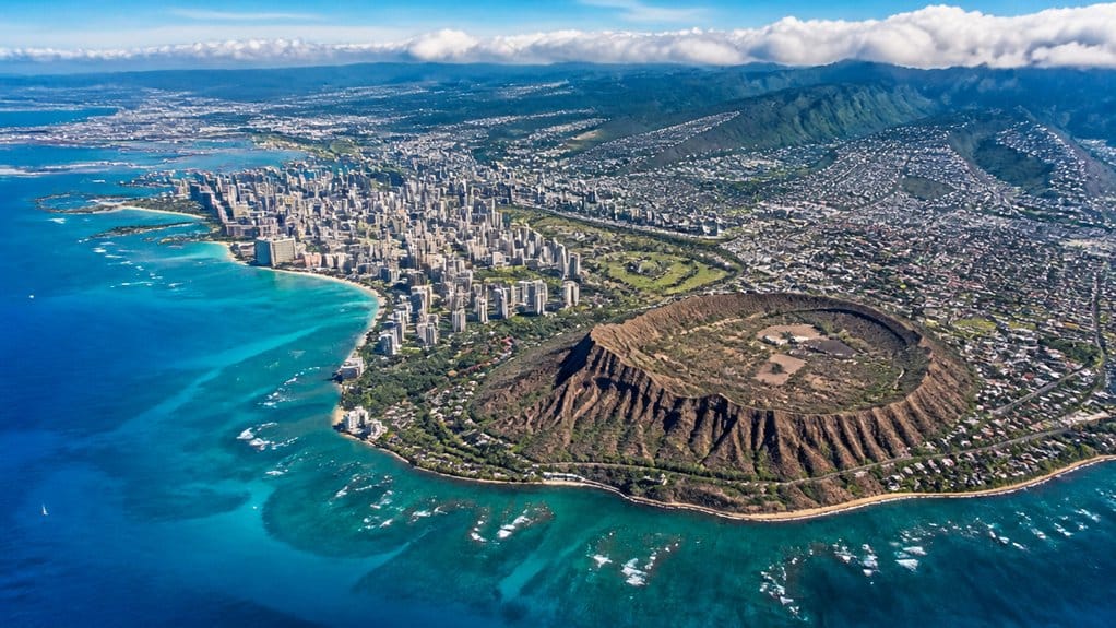
At first glance, it’s easy to think Honolulu is an island, especially when its name stands out on so many maps. But when you look closer, you’ll see Honolulu is a city on the Oahu island, not a separate piece of land in the Pacific.
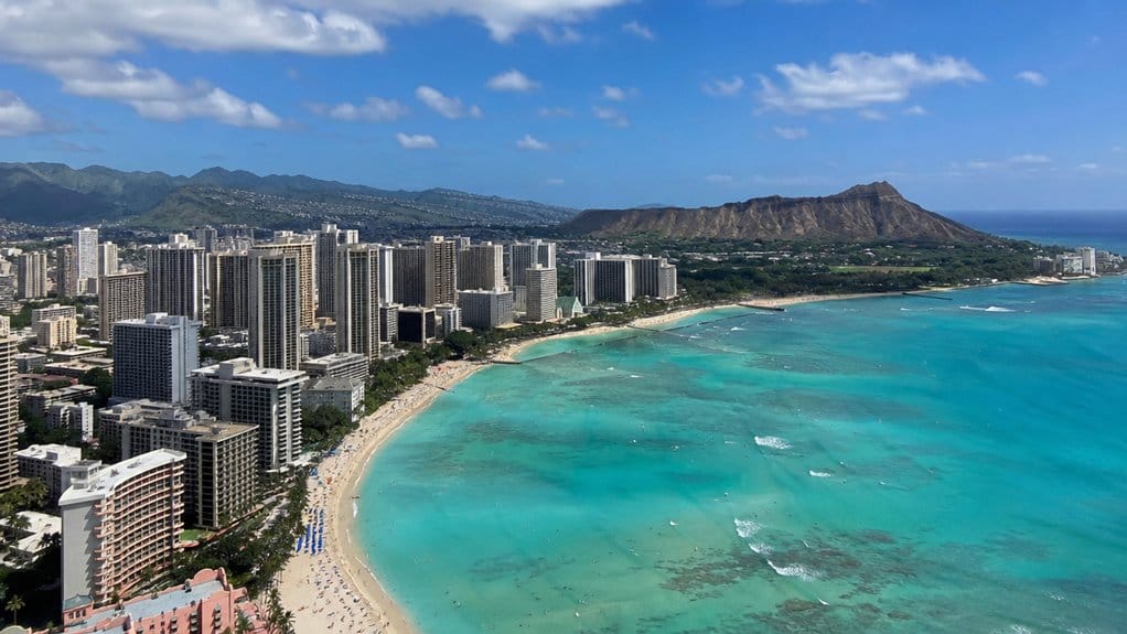
You’ll find Honolulu on Oʻahu’s southeast coast, where the urban shoreline stretches about 10 miles and reaches roughly 4 miles inland. Honolulu is also Hawaii’s capital, which is one reason its name appears so prominently on maps. On many maps, Honolulu marks the main built-up area, while Oʻahu names the whole island around it. That’s why travelers often spot Honolulu first. It’s the principal and major city here, and the dense core called Urban Honolulu fills in the busy streets, beaches, towers, and harbor views. This distinction matters when comparing Oahu vs Honolulu for trip planning, since one is the island and the other is its biggest city. In other words, you’re looking at a city label, not an island. Nearby Waikiki is a Honolulu neighborhood, not a separate city.
What’s the Difference Between Honolulu and Oʻahu?
Once you separate city from island, the difference between Honolulu and Oʻahu gets much easier to see. You’re looking at Oʻahu as the whole island, one of the Hawaiian Islands, and Honolulu as the main urban center on its southeastern shore. On most maps, Honolulu marks the downtown core, while Oʻahu covers the full 597 square miles. Oʻahu is not the Big Island, which is a separate Hawaiian island entirely. Oʻahu is often called the Gathering Place, a nickname that reflects its role as Hawaii’s most populated and visited island.
If you’re planning a trip, think of Oʻahu as the big stage and Honolulu as the city hub. Travelers choosing where to stay often compare areas like Waikiki and Kailua with Ko Olina or the North Shore, which all sit on Oʻahu beyond Honolulu’s downtown identity. Honolulu Harbor hums with ships, traffic, and salty air, but it doesn’t define the whole island. Beyond the city, you’ve got the North Shore, Windward Coast, Central Oʻahu, and Leeward Coast. Honolulu became the capital, but it isn’t one of several major cities spread across the island. Even Pacific University wouldn’t confuse those boundaries.
Where Is Honolulu on a Hawaii Map?
On a Hawaii map, you’ll spot Honolulu on the southeast coast of Oʻahu, the island that sits near the middle of the Hawaiian chain. To find it, first look for Oʻahu on a Hawaiʻi map, then trace the island’s lower right shoreline. That’s where Honolulu appears, usually near downtown and Honolulu Harbor, not across the whole island.
The city runs about 10 miles along the coast and reaches roughly 4 miles inland toward the foothills of the Koolau range. If you scan nearby labels, you may also notice Pearl Harbor to the west. Honolulu’s position makes practical sense. You’re looking at Oʻahu’s main urban center and port, where ships, planes, and people connect across Hawaiʻi and the Pacific. It’s a map location with real motion and salty air too.

Waikiki Trolley Hop-On Hop-Off Tour of Honolulu
Explore Waikiki and Honolulu with a choice of hop-on hop-off tours that feature the historic sites, scenic natural b...

Private Transfer Waikiki to Honolulu Airport HNL by Executive SUV
Why spend your precious time waiting in long shuttle or taxi lines. Avoid the language barrier and currency exchange...

Honolulu Airport & Waikiki Hotels Private Transfer by Minivan (up to 5 people)
Arrive in Hawaii feeling relaxed with a pre-arrange airport transfer waiting; Avoid navigating public transport or j...
What Part of Oʻahu Is Honolulu In?
Honolulu sits in the southeast part of Oʻahu, so if you’ve already found it on the map, you’re looking at one specific region of the island rather than all of it.
You’ll spot Honolulu along the southeast coast, stretching about 10 miles by the sea and 4 inland. Its core gathers around Honolulu Harbor. Downtown once centered on old Kou, near Nuʻuanu, Alakea, Hotel, and Queen. On an Oahu map, this places Honolulu within the island’s southeast region rather than across all of Oʻahu. If you’re planning to explore nearby landmarks, it helps to know Diamond Head hours before heading out.
| Area | What you’ll notice | Why it matters |
|---|---|---|
| Southeast Oʻahu | Honolulu coast | One island region |
| Harbor core | Busy piers | Main urban anchor |
| Old downtown | Historic streets | Early city center |
| Diamond Head | Landmark rim | Easy map cue |
| Kapiolani? | Park side | Tropical climate |
Think of Honolulu as Oʻahu’s urban southeast, with Diamond Head, Kapiolani?, Honolulu Hale (City Hall,State Capitol), and a tropical climate nearby too. If you’re deciding where to stay, Oahu neighborhoods can help match this urban area to your vacation vibe.
Where Is Honolulu in the Pacific?
Where exactly does Honolulu sit in the Pacific? You’ll find Honolulu on Oʻahu’s southeastern shore in Hawaiʻi, right in the central North Pacific of the Pacific Ocean. It belongs to the United States, but when you look at a map, it feels wonderfully far from the mainland.
The nearest continental point is Point Arena in California, about 2,045 nautical miles away, so you’re truly out in blue-water country. Honolulu stretches about 10 miles along the coast and reaches roughly 4 miles inland toward the Koʻolau foothills. You can picture the city backed by green ridges and fronted by busy harbor waters. Honolulu Harbor and nearby Pearl Harbor make it a major crossroads for ships and flights. Daniel K. Inouye International Airport, the state’s largest airport, sits here as a key neighbor-island hub for flights across Hawaiʻi and beyond. Even landmarks like the National Memorial Cemetery help place you in this Pacific setting today. Thanks to Honolulu’s generally consistent climate, shoulder seasons like late April to early June and September to mid-November are especially appealing times to experience its Pacific setting.
Why Do Maps Emphasize Honolulu?
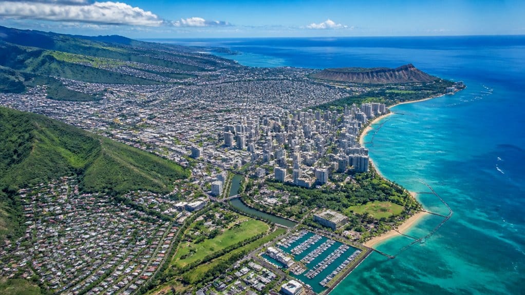
Why does Honolulu stand out so boldly on so many maps? When you look at Oʻahu, you’re seeing the capital of the Hawaiian Islands and the state’s biggest urban center. Cartographers highlight Honolulu because it anchors the island’s southeastern shore and helps you place yourself fast.
You also notice Honolulu because it’s a major engine for business, commerce, and finance. Ferries, cargo, and cruise activity pulse through Honolulu Harbor, while Pearl Harbor adds military weight and historic gravity. In the air, jets trace trans-Pacific routes that make the city a natural waypoint. On the ground, highways, hotels, offices, and neighborhoods spread out in a clear urban grid. Since Honolulu is a city on Oʻahu, not the whole island, maps spotlight the name so you won’t get gloriously lost too easily.
Frequently Asked Questions
How Do You Pronounce Honolulu and OʻAhu Correctly?
You pronounce Honolulu “hah-nuh-LOO-loo” and Oʻahu “oh-AH-hoo,” with a brief glottal stop. You’ll master Honolulu basics through visitor pronunciation, local spellings, common mispronunciations, regional accents, and Hawaiian language tips quickly.
What Time Zone Is Honolulu in Year-Round?
Honolulu stays on Hawaii–Aleutian Standard Time year-round, UTC−10:00, so you won’t adjust for daylight saving. You can use that for visitor planning tips, Honolulu weather patterns, parking and traffic, public transportation options, best neighborhoods to stay, island day trips.
Does Honolulu Observe Daylight Saving Time?
No, you won’t change clocks in Honolulu; you’ll track Honolulu history, embrace local culture, follow weather patterns, plan visiting seasons, compare transportation options, and explore must see neighborhoods, because Hawaii keeps the same time year-round.
What Is the Best Map App for Navigating Honolulu?
Google Maps works best for guiding Honolulu; you’ll get Getting Around help, Waikiki Routes, Public Transit Options, Traffic Patterns, Parking Tips, and Nearby Landmarks. If you’ve got an iPhone, Apple Maps also handles neighborhood turn-by-turn well.
How Far Is Honolulu From WaikīKī by Car?
You’ll drive about 3–6 miles from Waikīkī to central Honolulu in 10–20 minutes; traffic patterns affect travel time during rush. Check route options, parking in Waikīkī, parking rules, key landmarks, suggested stops, and road tolls/fees.
Conclusion
So if you’re scanning a Hawaii map, don’t go hunting for a separate Honolulu island. You’ll find Honolulu on Oʻahu’s southeast shore, wrapped around the harbor and stretching toward Waikīkī. Think of it as Oʻahu’s front porch, where city streets meet salt air and surf noise. That’s why maps spotlight it. It’s the island’s busiest hello, easy to spot, easy to reach, and hard to forget once you’ve pinned it in your mind today.

Private Arrival Transfer: Honolulu International Airport to Oahu Hotels or Cruise Terminal
Begin your Hawaiian vacation on the right foot with a luxury private transfer from the Honolulu International Airport (HNL) to your Oahu hotel or the...

Oahu Private Transfers at Honolulu Airport & Waikiki hotels
LUX CAB transfers much easier to book than ever. Book a transfer from Waikiki (any address or hotel) to Honolulu Int...

Private Departure Transfer: Oahu Hotels or Honolulu Cruise Terminal to Honolulu International Airport
End your Hawaiian vacation on the right foot with a luxury private transfer from your Oahu hotel or the Honolulu cru...

Private Airport Transfer from Honolulu to Ko Olina
We are the largest black car private transportation provider on Oahu. All vehicles are owned and operated by an empl...
Experiences to explore
 Explore experience ↗
North Shore & Circle Island Tour (Not Private)
◷ 6 hr–8 hr
Ideal for first-time visitors, or those with limited time, this full-day Island Tour takes you all around Oahu, making sure that you do
See dates for Current pricing
View dates Explore experience ↗
Oahu Circle Island Snorkeling Tour: Dole, Pali Lookout & More
◷ 10 hr–12 hr
Looking for the BEST VALUE & MOST COMPLETE Circle Island Snorkeling Tour? Join us for the ultimate full-day, action-packed adventure th
See dates for Current pricing
View dates Explore experience ↗
Oahu's Ultimate Grand Circle Island Tour with Snorkeling and More
◷ 10 hr
The "Most" Comprehensive Island Tour... Period! Top Sites: Byodo In Temple / Dole Plantation / North Shore Mac Nut Farm / China Man's H
See dates for Current pricing
View dates