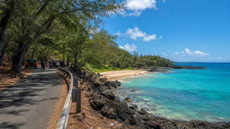
Like the back of a sleeping giant, Oʻahu rises in two main mountain ranges you’ll notice almost everywhere you go: the Waianae Range on the west and the Koʻolau Range on the east. One feels rugged and dry. The other drops in sharp green cliffs toward the windward side. Together they shape the island’s roads, weather, and views, and once you know where they run, the whole map starts to make a lot more sense.
Key Takeaways
- Oʻahu has two main mountain ranges: the Waiʻanae Range on the west and the Koʻolau Range on the east.
- The Koʻolau Range runs about 34 miles from Kahuku to Makapuʻu along Oʻahu’s windward side.
- The Waiʻanae Range separates Central Oʻahu from the Leeward Coast and creates a warmer, drier western landscape.
- The Koʻolau Range separates Central Oʻahu from the Windward Coast and is known for steep green cliffs and scenic lookouts.
- These ranges are the eroded remains of two ancient shield volcanoes, and Oʻahu has no active volcanoes.

Oahu's Stunning Views: Half-Day Scenic Tour with 7 Lookouts
Bless your eyes with Oahu's most beautiful wonders. We take you to the MOST IMPRESSIVE SCENEARIES of this island on a HALF-DAY TOUR. Explore the 7 IMP...

Oahu: Full or Half Day Grand Circle Island Tour
Choose from two exciting ways to experience Oahu's top attractions, scenic beauty, and local culture.Option 1: Dol...

Oahu Grand Circle Island Experience from Waikiki
Enjoy Grand Circle Island experience tour with breathtaking views of Amelia Earhart Lookout on Diamond Head, admire...
What Mountain Ranges Are on Oʻahu?
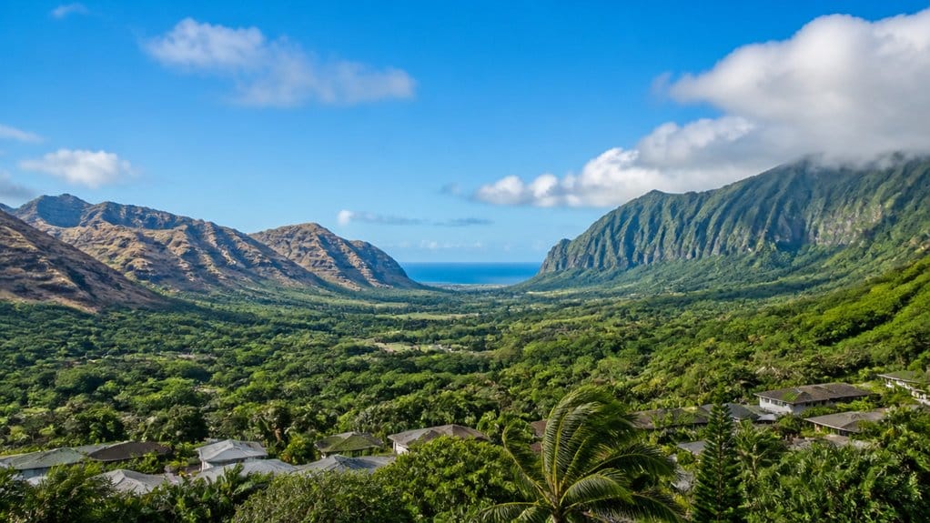
On Oʻahu, two main mountain ranges shape almost everything you see: the Waianae Range on the west and the Koʻolau Range on the east. As you travel the island, these ridges quietly organize the landscape. The Waianae Range walls off Central Oʻahu from the Leeward Coast. The Ko‘olau Mountain Range stretches along the windward side from Kahuku down to Makapuʻu. Together, the Koolau and Waianae Ranges define the island’s most recognizable terrain.
The Koʻolau Range is also known for stunning scenic lookouts and sweeping mountain views. It’s a favorite feature on driver-free tours that highlight Oʻahu’s best scenic stops without the hassle of navigating yourself. Between them, you’ll find the broad central plain, where towns, roads, and fields spread out with room to breathe. You can feel the contrast as you cross the island. One side opens to drier coastlines, while the other rises in steep green cliffs. Oʻahu also has smaller volcanic cones scattered around, like bonus landmarks. They pop up unexpectedly, as if the island couldn’t resist adding a few extra exclamation points.
How Oʻahu’s Mountain Ranges Formed
When you look at Oʻahu’s skyline, you’re seeing the worn backs of two giant shield volcanoes, Waianae and Koʻolau, that built the island and then slowly eroded into long ridges. You can still trace the drama in the Koʻolau collapse event, when a huge section slid into the Pacific and helped leave behind sights like Kāneʻohe Bay and the steep green cliffs you hear rustling in the trade winds. And just when you think the story’s over, later Honolulu eruptions remind you this island kept changing long after the main ranges had taken shape. One of those later events formed Diamond Head Volcano, a much younger tuff cone created by a single eruption long after Oʻahu’s main shield volcanoes. Although it looks different from the island’s broad mountain ranges, Diamond Head is still a volcano, specifically a tuff cone formed by a later eruption.
Twin Shield Volcanoes
Although Oʻahu looks like one island today, its two main mountain ranges began as separate shield volcanoes that rose from the sea millions of years apart. As you explore, you’re seeing the worn remains of the older Waianae Range in the west and the younger Ko‘olau Range in the east. Oʻahu’s landscape is the result of twin shield volcanoes that built the island in stages.
- Waianae began forming about four million years ago.
- Ko‘olau rose later and still dominates the windward skyline.
- Both volcanoes spread as broad shield domes, then went quiet.
- Their extinct cores now shape parallel ridges, valleys, and steep green walls.
You can trace that volcanic story in the landscape. The ridgelines run long and rough. Valleys cut deep between them. Later eruptions around eastern Oʻahu added landmarks through the Honolulu Volcanic Series. Not bad for two giants that have been sleeping for ages. Visitors planning to explore more of Oʻahu can use a simple 3 steps approach to organize their day. Visitors who want a different view of Oʻahu’s volcanic skyline can often spot parts of it from a Waikiki fireworks cruise on Friday nights.

Waikiki 2 Hour Sunset Sailing Catamaran Swim and Sail Adventure
There’s no better place to take a dip than the crystal-clear waters of Waikiki—and no better way to experience a...

Oahu: Kualoa Ranch UTV Raptor Tour
Traveling with family and friends? You can enjoy the fantastic Multi-passenger UTV Raptor experience with your entir...

Honolulu: Pacific Star Sunset Dinner Cruise and Show
Indulge in the original Pacific Rim cuisine, where each dish serves as a gateway to the rich flavors of the region...
Koʻolau Collapse Event
That long green wall of the Koʻolau Range looks solid enough to last forever, but it’s really the surviving half of a much larger volcano. When you trace the Ko‘olau Mountain Range today, you’re looking at the western side of ancient Koʻolau Volcano, after its eastern half collapsed and plunged into the Pacific years ago.
That prehistoric slide, often called the Nuuʻanu collapse, tore away an enormous section of the island. It scattered huge chunks of rock across the ocean floor nearly 100 miles northeast of Oʻahu. You can even connect Kāneʻohe Bay to that drama, because the bay marks the remnant of the old summit caldera. Afterward, the island’s shape changed dramatically. Oʻahu broke into separate pieces for a time, and the landscape you see now began taking form. In the rainy valleys below these mountains, trails like Manoa often stay slick because frequent showers keep the ground muddy long after storms pass. Today, hikers can see part of Oʻahu’s rugged coastal geology along the Kaʻena Point Trail, which runs toward the island’s northwestern tip. For another volcanic perspective on Oʻahu, the Diamond Head hike climbs 0.8 miles one way to a summit on the island’s southeastern side.
Later Honolulu Eruptions
Even after Koʻolau’s giant collapse reshaped Oʻahu, the island’s volcanic story wasn’t finished. When you look across eastern Oʻahu, you’re seeing the Honolulu Volcanic Series, a burst of later eruptions that restarted about 2.5 million years ago after a long quiet spell. These eruptions popped up on older volcanic ground and built many landmarks you can still hike, photograph, or sweat up today. Along Oʻahu’s north shore, areas like Pūpūkea and Waimea also showcase dramatic coastal geology, with lava tubes and rocky reef features offshore. Diamond Head is one of the most famous of these tuff cones, and a Diamond Head tour often includes shuttle access, timed entry tickets, and hiking tips for visitors. If you plan to explore these formations, learning about volcanoes on Oahu can help you visit them more safely.
- Diamond Head rose from this later phase.
- Koko Head and Koko Crater joined the skyline.
- Punchbowl, Tantalus, and Āliapaʻakai also formed.
- The last eruptions happened about 70,000 to 100,000 years ago.
The Waianae Range on Oʻahu’s West Side

On Oʻahu’s west side, the Waianae Range rises as the island’s older mountain backbone, stretching along the coast and dividing Central Oʻahu from the Leeward shore. When you look toward the west, you’re seeing Oʻahu’s older major range, about 4 million years old. The Waianae Range forms the island’s rugged western wall and helps shape the Leeward Coast.
Because trade winds drop less moisture here, the west side feels warmer and drier. You’ll notice sunbaked slopes, dusty ridges, and broad views that seem to run forever. Numerous ridges branch from the main spine, carving valleys and opening scenic overlooks across the region. Those ridges also create many of the west side’s signature vistas. Together with Oʻahu’s eastern range, this mountain mass helps define the island’s two-volcano landscape today.
Still comparing Oahu Mountain Ranges And Scenic Viewpoints?
Ask for tour ideas, hotel suggestions, or a simple trip plan that combines both.
Trip Helper
The Koʻolau Range on Oʻahu’s East Side
If you head to Oʻahu’s east side, the Koʻolau Range quickly takes over the view with its long wall of green cliffs and razor-backed ridges. You’ll spot this Ko‘olau Mountain Range stretching about 34 miles from Kahuku to Makapuʻu, dividing Central Oʻahu from the Windward coast. One of the best places to take in these ridges is Nuʻuanu Pali Lookout, a famous viewpoint often included in Oʻahu tour packages.
On Oʻahu’s east side, the Koʻolau Range steals the scene with green cliffs, sharp ridges, and a 34-mile spine.
- You can catch classic views at Nuʻuanu Pali Lookout.
- You’ll see cliffs rising behind Honolulu’s leeward neighborhoods.
- You’re looking at the remains of ancient Koʻolau Volcano.
- You can trace its story through eastern Oʻahu landmarks.
The modern range marks where the volcano’s eastern half slipped into the Pacific long ago, leaving Kāneʻohe Bay in the old summit caldera area. Most summits reach around 2,500 feet, so you get big scenery without Himalayan altitude. Nice trade for your legs, right? For a contrasting upland drive on the island, the Mount Tantalus lookouts offer scenic views above Honolulu from the slopes on Oʻahu’s south side. If you want another famous Oʻahu vantage point after taking in these ridges, Diamond Head reservations are worth planning ahead before you hike that crater trail.
Why the Koʻolau Range Looks So Dramatic
When you look at the Koʻolau Range, you’re seeing the battered edge of a giant volcano whose eastern side collapsed into the Pacific, leaving sheer walls and sharp ridges behind. You can spot that drama in the windward cliffs above Kāneʻohe Bay and from places like Nuʻuanu Pali Lookout, where the land seems to drop away all at once. The island’s southeastern side also offers a classic half-day hiking plan that pairs ocean views with volcanic scenery. Visitors heading toward the southeastern coast also use the Makapuʻu Lighthouse Shuttle to reach one of Oʻahu’s most scenic ridge-and-ocean viewpoints. And just when you think the scene can’t get wilder, younger cones nearby add extra bumps and bold shapes to the skyline. Some of the island’s most scenic waterfall hikes also pass beneath these lush ridges, and a few are reachable with relatively easy transit access.
Catastrophic Caldera Collapse
At first glance, the Koʻolau Range looks like a chain of separate mountains, but you’re really seeing the torn remains of one enormous volcano. The Ko‘olau Mountain Range got its bold shape from a catastrophic caldera collapse, not from many peaks rising one by one over time.
- One flank failed and plunged into the Pacific.
- Debris spread nearly 100 miles across the seafloor.
- The slide triggered a tsunami over 3,000 feet high.
- The remaining summit caldera became Kāneʻohe Bay.
Today, Oʻahu has no active volcanoes, so this dramatic landscape is a record of ancient geologic events rather than ongoing eruptions. When you trace Oʻahu on a map, that story snaps into focus. This wasn’t a small slump. It was a prehistoric island-shaping disaster, often tied to the Nuuʻanu landslide. Later eruptions added landmarks on eastern Oʻahu, but the range’s dramatic form still comes from that colossal break.

Oahu: Atlantis Submarine Adventure in Waikiki
Explore Waikiki’s marine mysteries while diving more than 100 feet underwater in an air-conditioned, eco-friendly...

Oahu's Circle Island Tour Operated By Fil-Am Travel & Tours
Take a tour to explore the island of Oahu as you follow along the majestic coasts with the steep mountains at your s...

Oahu Shark Dive on the North Shore
Book the Oahu Shark Dive for a thrilling shark encounter off the North Shore. You’ll travel by boat from Haleiwa H...
Windward Cliffs And Ridges
Because the Koʻolau Range is the torn wall of a single ancient volcano, Oʻahu’s windward side rises in a line of sheer green cliffs and narrow ridges that looks almost too steep to be real. From Nu‘uanu Pali Lookout, you can see how the Ko‘olau runs from Kahuku to Makapuu, towering above coastal towns. For travelers who want to pair those mountain views with the shoreline, the Makapuu Lighthouse route is a popular half-day option on Oʻahu.
Trade winds shove moist air into these slopes all year, so you get rain, mist, and that deep emerald cover that makes every fold look sharper. Valleys cut into the range, cliffs drop fast, and the ridges look like giant knife backs. The paved lighthouse trail at Makapuu makes it easy to enjoy similar cliffside scenery without committing to a long backcountry hike. You’ll notice the scenery keeps changing too. Kāneʻohe Bay opens wide below, while remnants of the old summit caldera add extra texture. It’s rugged, dramatic, and a little show-offy in the best way. For a different perspective over Honolulu, Tantalus Lookout offers a quick route to another scenic viewpoint on Oʻahu.
Younger Cones Nearby
If the Koʻolau cliffs already look like a giant ripped open the island, the younger cones nearby make the whole scene feel even wilder. As you look southeast, you’re seeing the youngest part of Oʻahu’s volcanic story. Koko Head looks especially fresh at about 32,000 years old, practically yesterday in island time. These extinct cones don’t build mountain ranges, but they sharpen the scenery.
- Koko Head adds a crisp crater rim beside older cliffs.
- Lahi rises like a bold punctuation mark above town.
- Powaina adds another volcanic bump to the skyline.
- Together, they make Koʻolau views feel layered and surprisingly recent.
You can feel the contrast from beaches, ridges, and roadside lookouts. Older shield remnants brood in the background while these later cones pop forward, rougher, steeper, and just a little showy. Visitors staying in town often pair these lookouts with Waikiki tours that simplify the day’s logistics and timing.
Why Windward Oʻahu Is Greener Than Leeward
While Oʻahu’s two mountain ranges sit almost side by side, they shape two very different worlds. When you stand on the windward side of the Koolau Mountain Range, you feel why it looks so green. Trade winds shove moist air uphill, and the steep cliffs force it higher. As that air cools, rain falls often, feeding waterfalls, wet valleys, and rainforest-like slopes. This pattern is especially noticeable in Honolulu weather discussions that compare wetter windward conditions with drier parts of the island.
Cross toward the Wai;anae Range and the change feels quick. You’ll notice warmer air, browner hills, and a drier landscape overall. The mountains run nearly parallel, but they split rainfall dramatically from east to west. Places near Nuʻuanu Pali show this best, where uplift happens fast and clouds pile up. These conditions are driven in large part by steady trade winds that bring moisture onto the island’s windward side. On the leeward coast, fewer showers mean less lush scenery. Nature’s sprinkler clearly has a favorite side. First-time visitors often notice this contrast clearly on Circle Island tours, which pass from lush windward scenery into the island’s drier leeward side.
Mount Kaʻala, Oʻahu’s Highest Peak
Higher than any other point on Oʻahu, Mount Kaʻala rises to 4,003 feet in the Waianae Range and gives the island’s drier west side its true summit. When you look toward this Waianae Mountain high point, you’re seeing Oʻahu’s older backbone, shaped about four million years ago. Mount Kaʻala sits in the west side highlands formed by an extinct shield volcano.
- You get broad mountain bowl views.
- Near dusk, bays often glow below.
- The air feels cooler and quieter.
- The leeward setting stays drier than Koʻolau.
That drier setting helps explain why this peak feels different from the island’s greener windward range. If you love geography with a side of drama, Mount Kaʻala delivers both, without needing to show off. Even the name sounds like it knows it’s special already. If your Oʻahu adventures also include the northwest coast, planning ahead matters because strong sun and tide pool safety can become part of the day at Kaena Point, and a Kaena Point permit reservation follows a 7-step process.
Diamond Head and Oʻahu’s Volcanic Cones
As you reach Diamond Head at the east end of Waikīkī, you’re standing on an extinct volcanic cone shaped by ancient eruptions that helped define Oʻahu’s landscape. You can trace its story back to the Honolulu Volcanic Series, when about thirty eruptions formed cones and craters across eastern Oʻahu, then went quiet long ago. If you look beyond Diamond Head, you’ll spot other rugged reminders like Punchbowl Crater and Koko Head, each one a dry, dramatic leftover from the island’s fiery past. Because entry now often requires tickets and reservations, it’s wise to plan ahead before setting out for the trail. Before visiting, it helps to check current fees and hours so you can plan your hike to this iconic crater more smoothly. If you’re driving in, reviewing the parking guide ahead of time can help you navigate the lot, tunnel access, and nearby alternatives more easily.
Diamond Head Origins
Though it feels like a dramatic backdrop to Waikīkī, Diamond Head is actually an extinct volcanic cone at the neighborhood’s eastern edge. When you look at it, you’re seeing one chapter in Oʻahu’s volcanic story, shaped first by the island’s two older shield volcanoes, including Waianae, then later by younger eruptions.
- Diamond Head formed during the Honolulu Volcanic Series.
- That eruptive period stretched across roughly 500,000 years.
- Surveys place the latest activity about 70,000 to 100,000 years ago.
- Today, you can spot its tuff slopes rising above streets and surf.
You don’t need a geology degree to appreciate the scene. The dusty crater, steep rim, and ocean light make Diamond Head feel cinematic. Still, its origins are real, fiery, and surprisingly recent in island time. It still steals every skyline glance.
Other Volcanic Cones
If you keep scanning past the big mountain backdrops, you’ll notice that Oʻahu is dotted with smaller volcanic cones that rise out of neighborhoods, parks, and dry coastal slopes. They’re leftovers from eruptions that came after the island’s main shield volcanoes built the land, and most stay under 1,000 feet tall and roughly a mile wide.
You can spot Diamond Head at Waikiki’s east end, but it’s only one piece of the picture. Unlike a typical roadside overlook, Diamond Head has driving rules that make hiking and shuttle access the better way to experience it. Punchbowl Crater stands closer to Honolulu, while Koko Head anchors the southeast side with a steeper, harsher look. Koko Head is also the youngest part of Oʻahu at about 32,000 years old. From the water near Turtle Canyon, these cones give the skyline a choppy, unmistakably volcanic edge. They’re small, but they don’t exactly whisper.

Waikiki Turtle Canyon Guided Snorkel: Turtle Guarantee
Choose Viator’s most-reviewed Turtle Canyon snorkel tour, with more than 4,800 traveler reviews and an experienced...

Waikiki Turtle Canyon Snorkel Turtles Guaranteed
Book our Turtle Canyon snorkel tour and experience one of Waikiki’s most popular turtle snorkeling destinations! D...
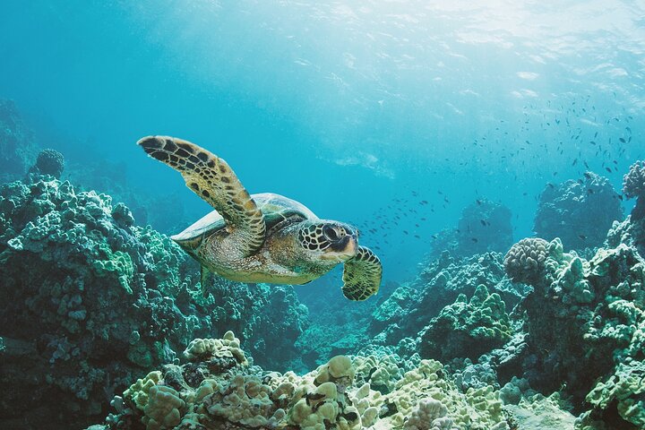
Waikiki: Turtle Canyon Snorkel Adventure on Oahu
Enjoy an exclusive snorkeling adventure in Waikiki with small group sizes for a comfortable and VIP experience. You...
How the Koʻolau Range Shapes Honolulu
While Honolulu often feels like a city of surf and streets, the Koʻolau Range quietly runs the whole backdrop. You see its steep green walls rising behind neighborhoods, pulling your eye from downtown toward misty ridges. This mountain chain helps define Honolulu’s weather, views, and sense of scale every day.
Behind Honolulu’s surf and streets, the Koʻolau Range shapes every view with steep green walls and misty scale.
- You notice greener valleys where trade winds squeeze out rain.
- You face the dramatic Nuʻuanu Pali, where 1795 history still clings.
- You glimpse ancient geology from a volcano split long ago.
- You feel how Honolulu leans toward the windward side beyond the peaks.
The Koʻolau Range gives Honolulu a wilder edge. It turns ordinary drives into cliff-framed scenes, and it makes the city feel tucked between sea and stone. That’s a pretty great roommate.
Oʻahu Roads That Cross the Koʻolau Range
When you need to get from Honolulu to the Windward Coast, the Koʻolau Range doesn’t just stand in the way. It also gives you three dramatic routes through steep volcanic ridges, all carved to save time and spare your brakes.
You’ve got Hawaii Route 61, better known as Pali Highway, which carries you from the leeward side toward the windward communities through the Koʻolau tunneling corridors. Hawaii Route 63, or Likelike Highway, offers another direct eastbound link and feels like the practical local favorite. Then there’s Interstate H-3, the newest and boldest crossing, built to move you quickly between Honolulu and windward destinations. Together, these roads turn the Koʻolau Range from a rugged barrier into a surprisingly efficient commute, with mountain walls doing the brooding while you keep rolling.
Best Oʻahu Mountain Lookouts
Where should you go first if you want Oʻahu’s mountains to do the talking? Start with Nuʻuanu Pali Lookout, where you can face the steep Koolau cliffs and watch the wind shove clouds across the Pali. It’s a quick stop, but the drama lingers.
- Try Koolau lookouts for green, wet windward scenery.
- Seek Awawaloa and Konahuanui views for jagged backcountry ridges.
- Head to the Waianae Range for broad west-side vistas.
- Go early if you want clearer skies and fewer elbows.
You’ll notice each range frames the island differently. The Koolau side feels cooler, wetter, and moodier, with trade winds often brushing your face. The Waianae side usually looks sunnier and drier, which can sharpen long views. Bring water, hold onto your hat, and let the ridgelines handle the storytelling.
Frequently Asked Questions
Are OʻAhu’s Mountain Trails Suitable for Beginners?
Yes, you’ll find beginner-friendly Oʻahu trails if you choose shorter, well-marked routes. Check Trail difficulty ratings, avoid steep ridge climbs, expect muddy footing after rain, and consider Guided tour options for safer, easier introductions.
When Is the Best Season for Mountain Hiking on OʻAhu?
You’ll get Oʻahu’s best mountain hiking from late fall through spring; winter trail conditions stay cooler and clearer, and spring wildflowers bloom. Start early for steep climbs, and bring extra water, sun protection, and layers.
Do OʻAhu’s Mountain Ranges Have Native Endangered Species?
Yes, you’ll find native endangered species in Oʻahu’s mountain ranges, where endemic habitats on wet Koʻolau and dry Waianae slopes support survival. You can also see their Cultural significance in traditional Hawaiian relationships with these landscapes.
What Should Hikers Pack for OʻAhu Mountain Weather Changes?
You’ll want layering basics: a light rain shell, breathable sleeves, and a compact warm layer, just right for sudden rainfall. Pack extra water, sun protection, supportive shoes, and a small day bag for changing trail conditions.
Are Permits Required to Hike in OʻAhu’s Mountain Areas?
No, you usually don’t need permits to hike Oʻahu’s mountain areas, but permits rules and trail access vary by trail. You should check trailhead signs, closures, fees, and land-management regulations before you go hiking.
Conclusion
On Oʻahu, you travel between two old guardians. Waianae stands rough and sun-baked to the west. Koʻolau rises green and sheer to the east. They frame your drive, catch the clouds, and open sudden views of Honolulu, the Windward Coast, and the sea. Cross at Pali or H-3 and you hear rain tap leaves, then watch the light change by the mile. Even Diamond Head joins the story, like a small but proud sidekick.
Oahu's Stunning Views: Half-Day Scenic Tour with 7 Lookouts
Bless your eyes with Oahu's most beautiful wonders. We take you to the MOST IMPRESSIVE SCENEARIES of this island on a HALF-DAY TOUR. Explore the 7 IMP...
Oahu: Full or Half Day Grand Circle Island Tour
Choose from two exciting ways to experience Oahu's top attractions, scenic beauty, and local culture.Option 1: Dol...
Oahu Grand Circle Island Experience from Waikiki
Enjoy Grand Circle Island experience tour with breathtaking views of Amelia Earhart Lookout on Diamond Head, admire...