
If you want a great Waiʻanae day hike, start with the unglamorous part: pick a legal route from Nā Ala Hele or a verified Outerspatial page, then confirm access, permits, and any gate rules before you lace up. Conditions change fast here. One ridge can be sun-blasted and dry while the next is slick with red mud and wrapped in fog. Add wind, limited shade, and a hard sunset cutoff, and your “quick hike” needs a real plan. The smart part comes next.
Key Takeaways
- Use only official Nā Ala Hele or Outerspatial routes, and verify trailhead access, permits, closures, and any Army or gate restrictions before hiking.
- Check same-day weather for your exact Waiʻanae route; fog, rain, heat, wind, and vog can quickly change visibility and footing.
- Start early and set a firm turnaround time, aiming to be halfway by noon and finished before sunset.
- Carry plenty of water, electrolytes, sun protection, quick-dry layers, a rain jacket, and sturdy trail shoes with traction.
- Download official offline maps, save key waypoints, obey gates and signage, and avoid unofficial shortcuts that damage fragile habitat.

Oahu: Full or Half Day Grand Circle Island Tour
Choose from two exciting ways to experience Oahu's top attractions, scenic beauty, and local culture.Option 1: Dole Plantation & Haleiwa Town (6.5 H...

Oahu Grand Circle Island Experience Departing from the Big Island
Big Island tour heads to the legendary North Shore, where world champions compete every November and December at fam...

Oahu Grand Circle Island Tour Departing from Maui
Maui tour heads to the legendary North Shore, where world champions compete every November and December at famous Wa...
Oahu Grand Circle Island Experience Departing from Maui
Maui tour heads to the legendary North Shore, where world champions compete every November and December at famous Wa...
Choose a Legal Waiʻanae Day Hike
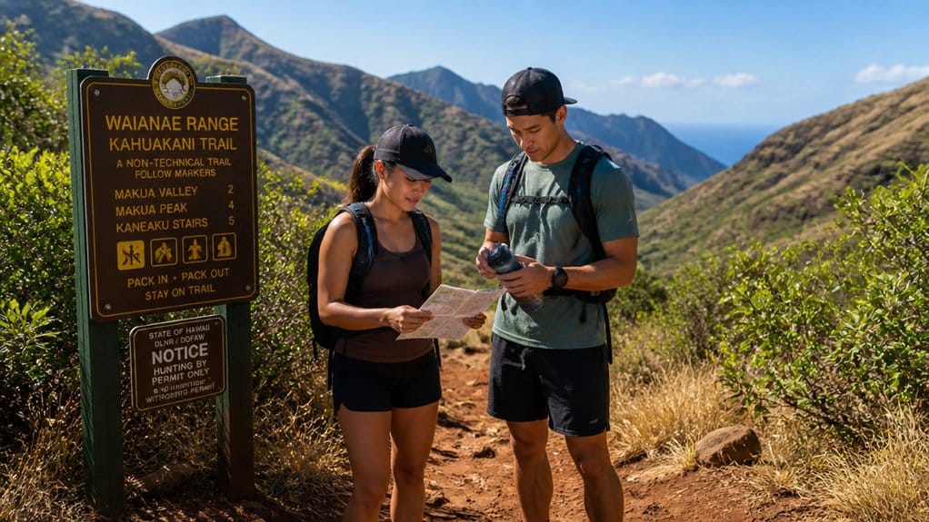
Before you lace up your shoes, make sure the hike you choose is actually legal. Start with the State of Hawaiʻi Nā Ala Hele network or verified details in the Outerspatial app. Those sources help you stay on public routes that protect native habitat and keep you off illegal shortcuts that scar slopes and crush plants. Only use routes shown in official sources, since official trails help protect sensitive habitat and keep hikers on managed access.
As you plan to hike, check your trailhead and full route, not just the pretty ridge photos. Some paths cross installation-restricted land, and you don’t want your day to end at a locked gate. If you’re eyeing historic trails or long ridge walks, compare distance and difficulty carefully. The Waiʻanae Summit Trail is 27.4 miles one way and often isn’t completed because both ends have access problems. Pick a legal day segment instead. If you choose a coastal Waiʻanae hike such as Kaʻena Point, remember the park keeps daily hours from 6:00am to 7:00pm and some vehicle gates require permit-based access. Just as visitors in Honolulu look for easy reefs that do not require a long drive, hikers in Waiʻanae should favor straightforward, legal day routes over ambitious plans with complicated access.
Check Waiʻanae Permits and Access Rules
A legal trail choice is only half the plan. Before you lace up, check Nāʻ Ala Hele and official Outerspatial pages for the exact trail, segment, and access road you’ll use. Those listings help you stay on authorized routes and avoid unofficial paths that cut through fragile native habitat. If your route reaches Kaʻena Point’s shoreline, remember that Hawaiian sea turtles are protected under the Endangered Species Act, so give them space and avoid disturbance.
If your route includes Kaʻena Point, review the permit reservation steps ahead of time so you understand the process before your hike day. Access gets trickier on the Waianae Summit Trail. Both ends pass through areas hikers aren’t supposed to enter without approval, so through-hikes are rare. If your route touches Army land or training areas, confirm whether access opens only on certain dates or requires a permission letter. For current city park guidance, you can also contact Honolulu’s Department of Parks & Recreation at 1000 Uluʻōhiʻa Street, Kapolei, or by phone before your trip. At the Mākua Valley ungulate fence gates near Kuaokalā Trail, read the signs, go through only where allowed, and latch the gate behind you. A good hike shouldn’t start with a rule break, ever.
Review Waiʻanae Trail Conditions and Closures
Before you go, check the official Nā Ala Hele or Outerspatial update for your exact Waiʻanae trail, because rain can quickly turn dirt to slick mud and leave loose rocks on steep sections or stream crossings. You should also scan for closures and access limits, especially near Army land, and confirm ahead of time if your route touches Schofield Barracks where a permission letter may be required. Don’t trust the map alone, so read the trailhead signs and same-day local updates since trails like Kalena, Kanehoa-Hapapa, or Puu Hapapa can close even when nearby routes still look good to go.

Oahu Majestic Circle Island Tour with Waimea Falls and Byodo Inn
Since 1974, E Noa Tours has specialized in showing visitors the real Oʻahu through immersive experiences led by pas...

Oahu: Grand Tour Around Island with Snorkeling
Come join on a circle island adventure led by some of Hawaii’s most knowledgeable local guides and experience brea...

Parasailing Experience in Waikiki, HI
Experience the thrill of Oahu parasailing on this unforgettable 1-hour adventure from Waikiki. Soar up to 1,000 feet...
Current Trail Access
Even if a Waiʻanae trail looks perfect on the map, you should confirm that your exact route segment is open in Hawaiʻi’s Nā Ala Hele or Outerspatial listings, because access can shift from one ridge or valley to the next. On the West Side, one Trail may be open while the next ridge isn’t. That quick check saves you a long drive and a locked gate. For coastal routes, it also helps to know basics like parking to the shore logistics before you leave home.
You should also match access with Weather conditions on your hike day. In Hawaiʻi, trade winds and passing rain can quickly change footing and visibility, even when the morning starts calm. Rain can turn dirt slick, loosen rocks, and make steep pitches or stream crossings feel louder and wilder than expected. Conditions can also change quickly with strong currents and limited visibility, so planning conservatively is the safer choice. Some routes, especially Kalena, Kanehoa-Hapapa, and Puu Hapapa, often overlap Army training areas. Others, like Kaunala, Pupukea Summit, and Wahiawa Hills, usually don’t. If your route crosses military land, timing can be limited, so verify details before lacing up.
Closures And Permits
Since Waiʻanae trail access can change fast, check Nā Ala Hele or the Outerspatial app for the official status of your exact route right before you go.
Unofficial trails are illegal and can damage native habitat, so stick to mapped routes. Closures shift with weather, safety work, and land management. Some Oʻahu routes near Army land may shut without notice, even if you’re coming from the North Shore. If your hike needs permission, request it at least 10 business days early and carry your letter. For hikes at Diamond Head, note that entry reservations are required for non-residents, and the last reservation to hike is 4:00 pm. If your plans include nearby coastal stops, remember that winter brings dangerous currents and wave conditions around Waimea Bay, Sharks Cove, and Three Tables.
| Check | Why | Action |
|---|---|---|
| Official status | Closures change fast | Verify before leaving |
| Permit needs | Some access is restricted | Apply early |
| Gate and parking lot | WST access is limited | Close gates, stage legally |
On WST, close the Mākua fence gate behind you always.
Watch Waiʻanae Weather, Heat, and Sunset
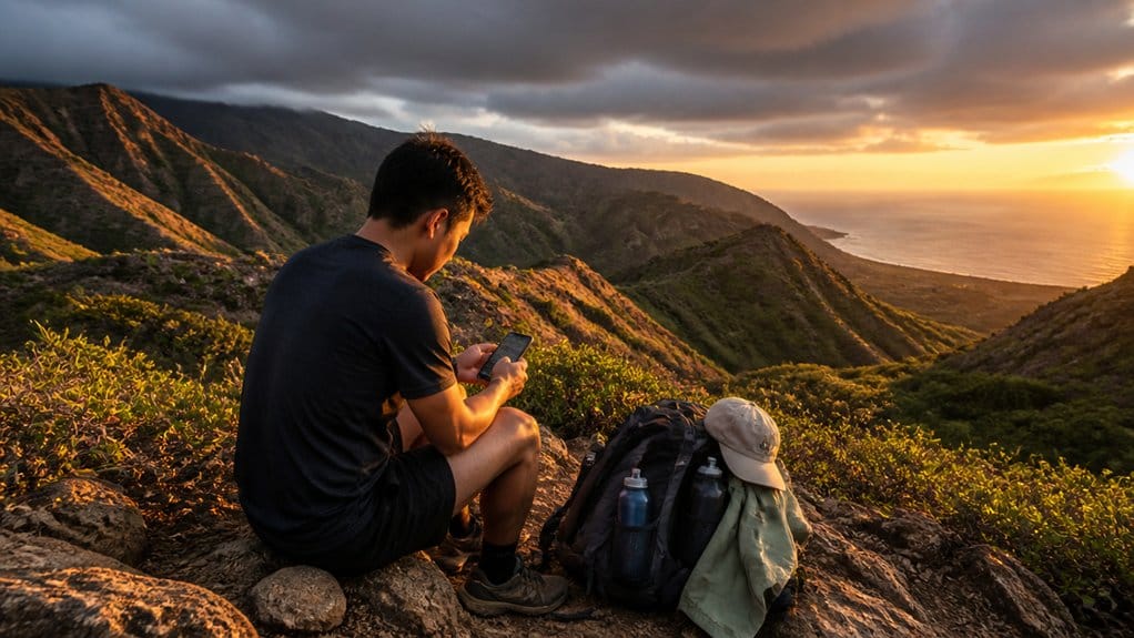
Because the Waiʻanae Range can shift from bright, dry ridges to misty interior valleys in a short stretch, check the forecast for the exact area you plan to hike, not just the coast. Conditions can change quickly between sunny western slopes and greener folds inland. As you watch Waiʻanae weather, think beyond blue sky. Wind, fog, rain, and vog can reshape the trail ahead.
Start early, especially in hotter, drier months, and aim to be halfway by noon. Many routes run two to three hours with little shelter, so heat and strong sun can wear you down fast. Oahu’s weather by month can help you anticipate hotter periods in Honolulu and the North Shore that often align with stronger sun exposure across leeward hikes. The most reliable hiking windows often fall in late spring and early fall, when trails are typically drier without peak summer heat. Keep an eye on cloud buildup around the peaks. If visibility starts closing in, turn around. Also watch sunset timing, and begin with enough daylight to finish safely. Sun protection matters, and darkness never hikes faster. Dry, gusty winds can also raise fire weather concerns on exposed leeward slopes, so avoid anything that could spark a brush fire.
Still comparing Nuʻuanu Pali Lookout And Mountain Views?
Ask for tour ideas, hotel suggestions, or a simple trip plan that combines both.
Trip Helper
Pack Water, Sun Gear, and Layers
Pack like the ridge means it. You should pack water generously, because Waiʻanae trails run hot, dry, and exposed. Start early if you can, then keep sipping instead of waiting until you’re thirsty. For longer climbs, add electrolyte tablets or capsules so sweat doesn’t quietly drain you.
| Bring | Why it matters |
|---|---|
| Hat, sunscreen | Hawaiʻi sun hits hard on open ridges |
| Quick-dry layers, rain jacket | Weather can cool fast after heat |
Choose proper clothing that dries fast, not cotton, and add a light extra layer. Morning conditions are often the easiest for outdoor plans, so an early start can also help you avoid harsher heat and busier conditions later in the day. Wear shoes with traction and support, since rocky stretches and sandy patches can shift underfoot. Leave slippahs behind. If your water runs low, your skin starts cooking, or wind chills you, turn around before the ridge makes the call.
Navigate Waiʻanae Trails With Offline Maps
Even if your phone shows one lonely bar and then gives up, you can still move with confidence if you download the exact Waiʻanae trail map before you go. Grab an official offline trail map from Nā Ala Hele or Outerspatial so no cell service means no drama. Use Outerspatial’s photos and offline navigation to confirm the named trail you want, especially near Kuaokalā where roads can impersonate routes.
Save key waypoints before Trail begins. Mark the Kaʻena Point predator-proof fence where the WST climb starts, plus the Mākua Valley ungulate fence gates. Build a simple turn list for junctions. On Kuaokalā Trail, head east toward Mākua Valley and watch for the left turn after the gate. Then do one last offline check on distance and exits before boots hit dirt. Just as a Waikiki Beach map helps visitors choose where to swim, surf, and find shade, an offline Waiʻanae trail map helps hikers confirm routes and decision points before losing service.
Start Early and Share Your Route Plan
Start early and Waiʻanae usually feels kinder. You’ll beat the hot, dry slopes and have a better shot at reaching halfway by noon, before afternoon rain starts playing tricks. Before you lace up, check conditions for your exact area. Wind, fog, rain, and vog can shift fast across Oʻahu’s mountains. In winter, expect passing showers more than all-day washouts, so a backup plan can save your day if trailheads are soaked.
- Start early and build a realistic turnaround window.
- Let someone know your route, your trail segment, and your expected finish time.
- If you’re choosing an access route or two trails, share waypoints and your trail definition.
- Include mileage and timing, like Kaʻena Point to Keālia at about 12.1 miles, plus extra effort.
If you stage Kaʻena to Keālia, you’ll skip a highway walk back. That’s smart planning, not laziness.
Know When to Turn Back and Protect Habitat
A good route plan also needs a firm exit plan. Before you start your hike, pick a turnaround time or distance and stick to it. In the Waianae Range, weather can flip fast. Sunny ridges can vanish behind cloud buildup, and wind or fog can swallow views along the trail.
Keep checking in with yourself as elevation gain adds up. If you’re behind schedule, not halfway by noon, or feeling more tired than expected, turn back. Do the same if mud gets slick, rocks loosen after rain, or your footing feels shaky. Stay on the official tread and don’t cut switchbacks. Shortcutting damages native habitat and widens scars. If you reverse course, do it early, move carefully, and avoid trampling plants at the trail’s edges.
Frequently Asked Questions
Are Trekking Poles Helpful on WaiʻAnae Ridgelines?
Yes, they’re helpful on Waiʻanae ridgelines. You’ll gain stability on rocky, uneven tread and reduce leg strain. For safer trip planning, do weather checks, practice careful pole placement, and use route sharing while carrying enough water.
Can Beginners Safely Hike the WaiʻAnae Range Alone?
Yes, but you shouldn’t start alone unless you’ve got weather awareness, water planning, and navigation basics dialed in. The range can turn on a dime, so choose short official trails, turn back early, and hike conservatively.
What Footwear Works Best for Loose WaiʻAnae Terrain?
Choose boots or trail shoes with strong Trail grip for loose Waiʻanae terrain. You’ll want traction options like deep lugs and water-resistant materials, plus secure hiking shoe fit. Skip flip-flops; shake out sand between changing surfaces.
Are Dogs Allowed on WaiʻAnae Range Trails?
Dogs aren’t always allowed on Waiʻanae Range trails; you need to check each specific trail’s Lei rules first. Follow leash laws and trail etiquette, keep your dog leashed, clean up waste, and expect restrictions near sensitive areas.
How Fit Should I Be for a WaiʻAnae Day Hike?
You should have at least intermediate fitness for a Waiʻanae day hike. Use a fitness assessment, build elevation readiness, handle heat and rocky trails, and include emergency planning so you won’t get stranded by slower-than-expected conditions.
Conclusion
Plan well and Waiʻanae rewards you with legal trails, clear timing, and fewer bad surprises. Ironically, the wildest views often come from the most careful choices. You check gates, download maps, fill bottles, and leave early. Then you get the good stuff: red dirt underfoot, trade winds in your ears, and long ridges glowing above the coast. If heat builds or clouds drop, you turn around. That’s not missing out. That’s how you hike smart enough to return.

Pearl Harbor, USS Arizona Memorial & Honolulu Deluxe Coach Tour
Discover Pearl Harbor and historic Honolulu aboard a spacious Deluxe Gold Royal Star coach featuring panoramic windows, reclining seats, seat belts an...

Waikiki Trolley Ocean View Blue Line
Blue Line: Sights that will take your breath away. The Blue Line is called “Coastline & Local Grindz” Line for a...

Hidden Gems of Oahu Circle Island Tour with Byodo In Temple
Join Go Tours Hawaii as we embark on an Unforgettable Oahu Circle Island tour adventure as we journey through Hawaii...

Salute to Pearl Harbor Tour
Stand at ground zero of the infamous attack and gaze up at a sky once filled with enemy planes. This is the place wh...
Experiences to explore
 Explore experience ↗
Authentic Tahitian Dance Workshop with Former Miss Tahiti
◷ 30 min
Step onto the dance floor and immerse yourself in the vibrant world of Ori Tahiti, the traditional dance of Polynesia. This engaging wo
See dates for Current pricing
View dates Explore experience ↗
Pearl Harbor Arizona Memorial - Honolulu Tour - Submarine Access
◷ 5 hr–6 hr
Around 8am on December 7th, 1941, Japanese warplanes attacked Pearl Harbor and the Island of Oahu. The surprise attack killed 2,403 and
See dates for Current pricing
View dates Explore experience ↗
Early Access Pearl Harbor & USS Arizona Small-Group Tour
◷ 5 hr–6 hr
Enjoy an interesting half day excursion with early access to Pearl Harbor National Park. Experience Pearl Harbor at its most serene: he
See dates for Current pricing
View dates