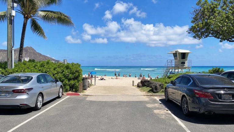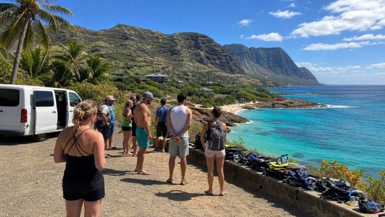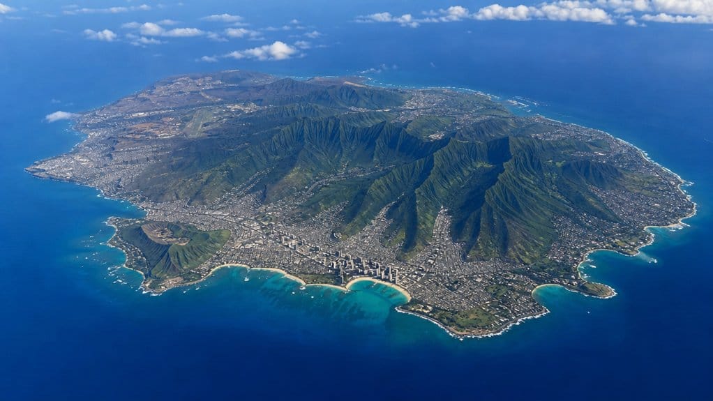
You might expect Oʻahu to feel huge, but it doesn’t. The island covers about 597 square miles, stretches roughly 44 miles across, and rises fast from warm beaches to cloud-brushed peaks over 4,000 feet. You can hear surf in the morning and stand in cool mountain air not long after lunch. That compact scale shapes everything from road trips to weather, and it explains why Oʻahu feels both easy and full of surprises.
Key Takeaways
- Oʻahu covers about 596.7 square miles, making it the third-largest of Hawaii’s main islands.
- The island stretches roughly 44 miles east to west and about 30 miles north to south.
- Oʻahu has about 227 miles of shoreline, so you’re rarely far from the ocean.
- Its highest point, Kaʻala, rises just over 4,000 feet above sea level.
- Oʻahu is smaller than Rhode Island, at about 0.49 times its total area.

Oahu Grand Circle Island Experience from Waikiki
Enjoy Grand Circle Island experience tour with breathtaking views of Amelia Earhart Lookout on Diamond Head, admire Chinaman’s Hat in front of Kualo...

Oahu: Grand Tour Around Island with Snorkeling
Come join on a circle island adventure led by some of Hawaii’s most knowledgeable local guides and experience breathtaking lookouts to capture mind-...
How Big Is Oahu?
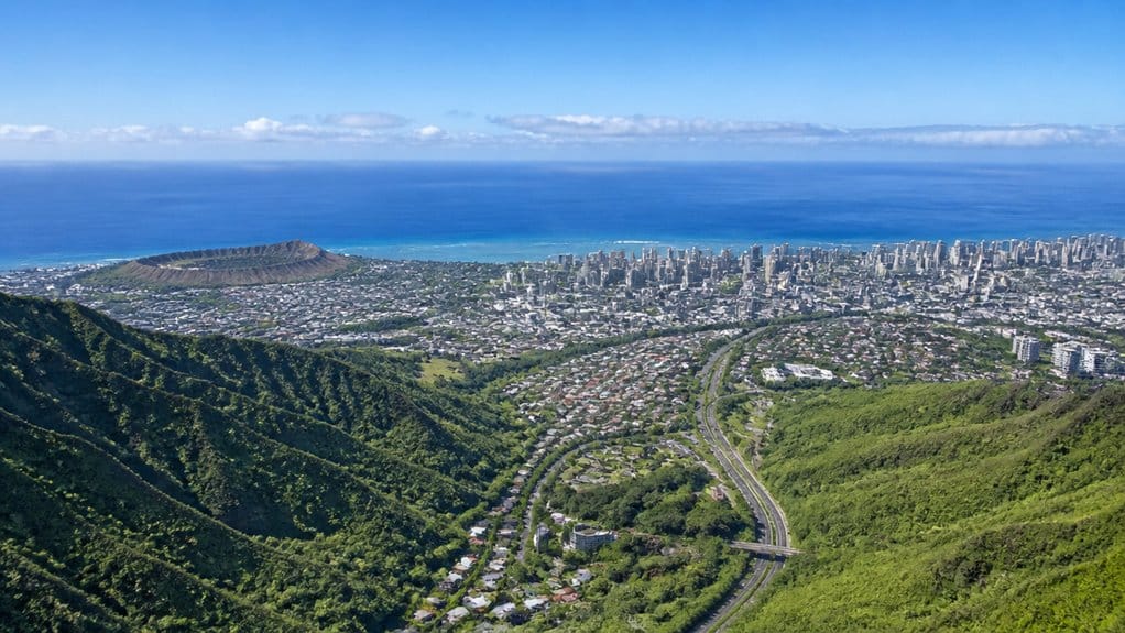
At first glance, Oʻahu can seem compact on a map, but it’s bigger than many visitors expect. When you look at the numbers, the island covers about 596.7 square miles of Land Area. That makes Oʻahu the third-largest of the main Hawaiian Islands, which gives you a better sense of its scale before you ever land. Oʻahu measures roughly 44 miles long and about 30 miles across at its widest point, which helps put its overall footprint into perspective.
You feel that size in more than statistics. Oʻahu rises to Kaʻala, its highest point, at just over 4,000 feet, where the air turns cooler and the views stretch wide. As the island that includes Honolulu, Oʻahu also serves as the center of population, culture, and transportation in Hawaiʻi. Oʻahu is often mistaken for the Big Island, but they are entirely different islands. The island also has about 227 miles of shoreline, so you’re never far from salt spray, trade winds, and the sound of surf. For a quick comparison, Oʻahu is about 0.49 times the size of Rhode Island. Smallish, sure, but hardly tiny.
How Long and Wide Is Oahu?
If you look at Oʻahu on a map, you’ll see it stretches about 44 miles from east to west and roughly 30 miles from north to south. As you travel across it, that broad valley between the Waiʻanae and Koʻolau ranges helps shape the island’s wide, folded feel. For popular North Shore stops, knowing best parking times can make it easier to cover more of the island in a day. Oʻahu’s east-west span is one of the key dimensions travelers notice when exploring how wide the island feels in person. If your route includes Honolulu landmarks, planning ahead for Diamond Head parking can also save time while crossing different parts of the island. You can cover a lot of ground, but with nearly 600 square miles and Kaʻala rising above it all, Oʻahu won’t feel small for long.
East-To-West Distance
From tip to tip, Oʻahu runs about 44 miles east to west, so the island feels longer than many first-time visitors expect. When you picture the island, think of a stretched shape rather than a neat circle. That east–west distance marks Oʻahu’s longest straight-line reach and helps explain why drives can feel surprisingly varied.
As you move across the island, you connect very different landscapes in one sweep. You pass volcanic ridges, busy city blocks, and quieter country stretches without ever leaving the same island. That variety is one reason an Oahu circle drive feels so practical for seeing multiple sides of the island in a single day. Scenic stops along the way make driver-free tours a simple option for taking in Oʻahu’s lookout views without navigating the roads yourself. Near the central-west area, Kaʻala rises to just over 4,000 feet and anchors the interior skyline. Oʻahu covers about 597 square miles overall, but that number feels abstract. The 44-mile length is easier to imagine, and a lot more useful when you plan your day. An Oahu map also makes it easier to see how the island’s regions and beaches line up along a simple driving loop.

Oahu's Circle Island Tour Operated By Fil-Am Travel & Tours
Take a tour to explore the island of Oahu as you follow along the majestic coasts with the steep mountains at your s...

Pearl Harbor, Dole, and Polynesian Cultural Center from Waikiki
Join us on an unforgettable day at three of Oahu’s most popular attractions: Pearl Harbor, Dole Plantation, and Po...

Pearl Harbor USS Arizona Memorial Tour from Waikiki
Turn back time as we explore WWII history at Pearl Harbor and relive the infamous Sunday morning of December 7, 1941...
North-To-South Span
Seen top to bottom, Oʻahu spans about 30 miles north to south, so its width feels manageable even when the day gets ambitious. In the United States, that’s a tidy distance. You can think of the island as a broad rectangle, compact enough that crossing it usually means tens of miles, not hundreds.
| Measure | Figure |
|---|---|
| North to south | 30 miles / 48 km |
| Island position | 21.5°N, 158.0°W |
From cool uplands to salt-bright shores, you’ll notice how quickly scenes can change. From Waikiki, even a landmark like Diamond Head is close enough to reach by walk, bus, Uber, or tour. If you’re fitting in a Waikiki evening on the same day, a sunset sail is often easier to pair with daytime plans because it keeps the schedule flexible. Drive a while and the air shifts, palms rustle, and surf starts sounding closer. Oʻahu still reaches 44 miles east to west, yet its north-south span stays relatively short, which helps you plan ambitious beach days without feeling like you’re crossing a continent before lunch.
Where Is Oahu in Hawaii?
Picture Oʻahu as the lively heart of Hawaii, set in the middle of the Pacific and easy to spot on a map of the island chain. You’ll find it in the Hawaiian archipelago, part of the United States, near 21.5°N and 158.0°W. From California, it sits about 2,400 miles west. From Japan, it’s roughly 3,850 miles east. Many travelers mix up Oahu vs Honolulu, but Honolulu is the capital city located on Oʻahu rather than a separate island.
When you arrive, you usually touch down at Daniel K. Inouye International Airport in Honolulu on the island’s southeast coast. As Hawaii’s largest airport, it also serves as a key hub for neighbor-island flights across the state. Many visitors heading to Waikiki choose transportation from HNL such as shuttles, rideshares, or taxis for the short trip after landing. That first step often comes with warm air, jet noise, and the scent of plumeria if the breeze cooperates. Oʻahu is called The Gathering Place, and you can feel why around busy Honolulu and Waikīkī, where streets hum, surf rolls in, and the island seems to welcome everyone. It feels central, connected, and unmistakably Hawaiian.
Is Oahu the Biggest Hawaiian Island?
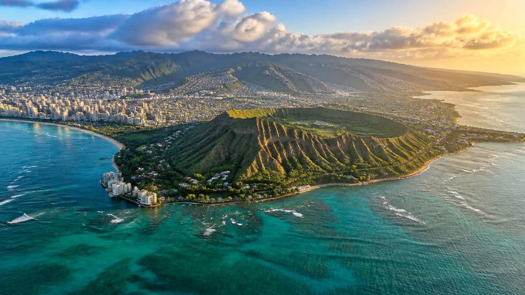
How big is Oʻahu compared with the rest of Hawaii? You might expect this famous island to be the biggest, especially when Honolulu, surf towns, and busy beaches fill your mental map of the Pacific Ocean. But Oʻahu isn’t number one.
- Oʻahu ranks as the third-largest Hawaiian island by land area.
- It covers about 596.7 square miles or 1,545.4 square kilometers.
- It’s the most populated island, yet crowd size doesn’t change land size.
For many travelers, its popularity also comes from its first-time attractions, which help make Oʻahu one of Hawaii’s most visited islands. If you want to enjoy that space with fewer people around, shoulder seasons like late April to early June and September to mid-November are often ideal for visiting Honolulu. You can also look up to Kaʻāla, Oʻahu’s highest point, which rises about 4,003 to 4,025 feet. That’s impressive. Still, height doesn’t make it Hawaii’s largest island either. So if you’re measuring pure size, Oʻahu gives you plenty to explore, just not the top spot in the chain. On Oʻahu’s far northwest side, Kaʻena Point State Park shows how much remote coastline the island still preserves.
Still comparing Oahu Island Size And Geography?
Ask for tour ideas, hotel suggestions, or a simple trip plan that combines both.
Trip Helper
How Does Oahu Compare to Rhode Island?
For a quick mainland comparison, Oʻahu is about 0.49 times the size of Rhode Island, so it’s smaller overall than the Ocean State. If you want a fast mental picture, think of Oʻahu as coming in at just under half of Rhode Island’s total area.
That single 0.49 multiplier gives you the point right away. Travelers who want to pair size expectations with timing should know that May deals are often among the best values for Honolulu trips. When you compare square miles, you can see Oʻahu doesn’t match Rhode Island in overall footprint. Rhode Island serves as your familiar reference, while Oʻahu is the island you’re sizing up. It’s a neat shortcut for understanding scale without pulling out a map or calculator. You can use the comparison to ground your expectations before a trip. Since island planning also depends on logistics, some places like Kapiʻolani Park have park closure hours from 12:00 a.m. to 5:00 a.m. In simple terms, Oʻahu takes up less space, and Rhode Island covers more ground. Before you go, it also helps to review a few Oahu travel tips so you can connect the island’s size with realistic plans for getting around.
Why Does Oahu Feel Bigger Than It Is?
Why does Oʻahu seem to stretch beyond its numbers? You can cross just 596.7 square miles, yet the island keeps changing around you. In a single outing, you move from city blocks to windward cliffs, surf towns, and green valleys. That variety tricks your sense of distance in the best way.
Oʻahu feels larger than it is because every turn shifts the scenery, changing your sense of distance.
- You follow about 227 miles of shoreline, and each coast feels like a fresh chapter.
- You drive roughly 44 miles east to west, but mountains, bays, and beach stops make it feel longer.
- You see steep volcanic ridges rise toward Kaʻala, over 4,000 feet high, so short routes feel dramatic.
As the Gathering Place, Oʻahu packs commerce, sights, and energy into busy districts that can feel like a whole region before lunch even arrives. You also notice how TheBus routes, driving times, and organized tours can make the island feel either compact or surprisingly expansive depending on how you explore it. Many North Shore tours from Waikiki also reinforce that feeling by connecting Waikiki hotel pickup with a day that crosses several of Oʻahu’s distinct landscapes.
How Many People Live on Oahu?
Nearly 1 million people call Oʻahu home, with about 998,747 residents in 2024, so this island doesn’t just feel lively, it is. When you drive the coast, browse markets, or hear beach parks buzzing at sunset, you’re feeling the pull of a place where people actually live, work, and gather. That constant activity also shapes vacation vibe choices across Oʻahu’s neighborhoods, with different areas offering noticeably different local energy.
That number dipped from 1,016,494 in 2020, but Oʻahu still holds about 70% of the total population of the Hawaiian Islands. In other words, if you want to understand everyday Hawaiʻi, you start here. Most residents also live in or near the island’s main urban zone, which helps explain the steady traffic, packed plate-lunch spots, and full beaches. Oʻahu also anchors the City and County of Honolulu, so you’re not imagining it. Honolulu is the capital of Hawaiʻi, which further underscores Oʻahu’s role at the center of life in the islands. Honolulu as capital also reinforces Oʻahu’s role at the center of life in Hawaiʻi. This island carries serious daily energy.

Honolulu: Pacific Star Sunset Dinner Cruise and Show
Indulge in the original Pacific Rim cuisine, where each dish serves as a gateway to the rich flavors of the region...

Pearl Harbor USS Arizona Memorial & Battleship Missouri
Visit USS Arizona and Battleship Missouri, as they represent both the beginning and the end of World War II. The acc...

Oahu: Atlantis Submarine Adventure in Waikiki
Explore Waikiki’s marine mysteries while diving more than 100 feet underwater in an air-conditioned, eco-friendly...
How Big Is Honolulu on Oahu?
When you ask how big Honolulu is on Oʻahu, you’re really measuring three things at once: the city’s land area, the dense urban core on the southeast coast, and the island-wide City and County boundaries. Honolulu is not its own island, but the main city on Oʻahu, which you can spot in the central Pacific on a map of Hawaiʻi. You’ll find most of Oʻahu’s people clustered in and around Honolulu, where the shoreline hums with traffic, towers, and beaches while the island’s higher interior stays far less built up. A good Honolulu map also helps show how neighborhoods, major sights, and transit routes fit together across the urban core. That contrast matters because Oʻahu is only about 596.7 square miles, so Honolulu takes up an outsized role even if you can still drive from city streets to quieter corners without packing a lunch. In summer, Honolulu’s busy shoreline feels even more concentrated as trade winds usually keep beach areas active and comfortable despite the strong sun.
Honolulu Land Area
How big is Honolulu on Oʻahu? When you picture the honolulu land area, you’re looking at the island’s southeast coast within Oʻahu’s 596.7 square miles. That setting helps you see Honolulu as part of a larger island, not a separate place. You can drive across Oʻahu’s roughly 44-mile length or its 30-mile width and feel how Honolulu fits into that frame. If you’re planning evenings in town, giving a luau night its own space can also help you understand how Honolulu fits into a broader Oʻahu itinerary.
- Oʻahu gives Honolulu its physical context, with broad lowlands backed by mountain ranges.
- The island’s 227 miles of coastline shape the southeast shore you’ll likely explore first.
- Honolulu’s government boundaries stretch far beyond the city itself, covering all of Oʻahu and even the Northwestern Hawaiian Islands.
Waikīkī is a Honolulu neighborhood, not a separate city, which helps clarify how visitors often picture one part of Honolulu as if it were its own place. Visitors often use hop-on hop-off tours to get a clearer sense of how Waikīkī and greater Honolulu connect across the island’s south shore.
Nearby, Kaʻala rises above 4,000 feet, while the central valley helps guide where Honolulu’s lower land spreads.
Urban Core Size
Why does Honolulu feel so big on Oʻahu? Because when you arrive, you meet the island’s main urban core almost right away. Honolulu stretches along Oʻahu’s southeast coast, where dense neighborhoods, busy roads, towers, and beaches line the southern shore. You see city blocks, hear traffic, and still catch trade winds off the water. Even within this urban core, shoulder seasons like April, May, September, and October can make the city feel more breathable for visitors.
Yet Honolulu covers only part of Oʻahu, which spans about 596.7 square miles. That contrast makes the city feel larger than it is. Most of the Hawaiian Islands’ population lives on Oʻahu, and about 81 percent live in or near the Honolulu urban area. Popular places to stay across the island include Waikiki, Kailua, Ko Olina, and the North Shore. Visitors exploring this busy hub often compare attractions with a Go City Pass before planning their Honolulu itinerary. So when you think of daily life, business, and movement across Hawaiʻi, Honolulu naturally feels like the center. It’s the island’s metropolitan heartbeat, compact but undeniably powerful and always busy too.
Island City Boundaries
Across Oʻahu, the name “Honolulu” can mean two very different things. When you hear Honolulu, you might picture the dense urban core by the south shore. But officially, the City and County of Honolulu covers all of Oʻahu, plus the Northwestern Hawaiian Islands, so the map gets much bigger fast.
- Oʻahu itself spans about 596.7 square miles with 227 miles of shoreline.
- The island runs roughly 44 miles east to west and 30 miles north to south.
- About 81% of Hawaiʻi’s people live in or near Honolulu’s urban area on Oʻahu.
That means Honolulu dominates the island’s footprint, even though ridges, coasts, and Kaʻala’s 4,003 to 4,025 foot high point keep city limits from stretching forever. Islands don’t do endless suburbs, thankfully anyway.
How Is Oahu Laid Out by Region?
At a glance, Oʻahu makes the most sense when you picture it in four main regions, each with its own mood and scenery. Honolulu and Waikīkī form the busy southeast core, where you’ll find major attractions, shopping, museums, and the island’s thickest concentration of hotels and services.
Head east and you reach the Windward side, where Kāneʻohe Bay and Lanikai feel greener, wetter, and more tropical. That lush look isn’t your imagination. Kāneʻohe Ranch once logged 247 straight rainy days. On the west and southwest, the Leeward side feels drier and more open, with Ko Olina resorts and the Waianae Range rising behind them. Then there’s the North Shore, stretched along the northern coast, where rural towns, famous surf breaks like Banzai Pipeline, and broad beaches give you Oʻahu’s classic wave-chasing postcard scene.
How Long Does It Take to Drive Oahu?
How long it takes to drive Oʻahu depends less on the island’s raw size and more on where you start, where you’re headed, and which side of the mountains you need to cross. Oʻahu stretches about 44 miles long and 30 miles north to south, but roads, ridges, and shoreline routes shape your day.
- From Waikīkī or Honolulu to the North Shore, you’re crossing much of the island, so the drive feels longer.
- Heading Windward toward Kāneʻohe or Lanikai often takes more time than going to nearby Leeward spots like Pearl Harbor.
- Since the shoreline runs about 227 miles, your real driving distance often exceeds what the map suggests.
If you plan around your starting point and final stop, you’ll move smarter and spend less time staring at brake lights ahead.
What Can You See on Oahu in One Day?
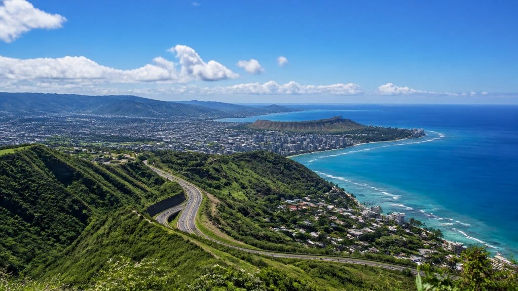
Once you know the drive times, planning a one-day look at Oʻahu gets a lot easier. You can start in Waikīkī, then hit Pearl Harbor and ʻIolani Palace before choosing a coast.
| Area | See | Best for |
|---|---|---|
| Waikīkī | Beach | Sunrise |
| Pearl Harbor | USS Arizona | History |
| North Shore | Pipeline, Sunset | Surf views |
| Windward | Lanikai, Mokes | Kayak, snorkel |
| Town trails | Mānoa or Koko Head | Quick hike |
If you want classic city sights, stay around Honolulu. If you want ocean variety, drive east for Hanauma Bay or Kāneʻohe Bay, then continue to Kailua and Lanikai’s pale sand. For a looser day, go North Shore, watch waves detonate at Banzai Pipeline, stroll Sunset Beach, and grab lunch from Food trucks. You’ll cover a lot without feeling rushed at all.

Parasailing Experience in Waikiki, HI
Experience the thrill of Oahu parasailing on this unforgettable 1-hour adventure from Waikiki. Soar up to 1,000 feet...

Waikiki 2 Hour Sunset Sailing Catamaran Swim and Sail Adventure
There’s no better place to take a dip than the crystal-clear waters of Waikiki—and no better way to experience a...

Waikiki Glass Bottom Boat Cruise
Experience the beauty of Oʻahu South Shore as we sail toward Lēʻahi (Diamond Head) aboard the spacious Haleiwa Qu...
How Do Oahu’s Coastline and Mountains Shape Its Size?
Although Oʻahu measures about 44 miles east to west and roughly 30 miles north to south, it feels bigger and more varied because mountains and shoreline keep reshaping the land around you. Its 596.7 square miles unfold around 227 miles of coast, so the island never reads like a simple block.
- You see two old shield volcanoes, Waiʻanae and Koʻolau, split by a broad saddle that breaks the land apart.
- You notice steep interior heights like Kaʻala, rising just over 4,000 feet, which keep much of Oʻahu from spreading flat.
- You feel the coast stretch and bend past places like Waimea Bay, while warm trade winds and wet windward slopes, including Kāneʻohe’s famously rainy streak, give the shoreline and mountains distinct moods from side to side.
What Does Oahu’s Size Mean for Travelers?
For travelers, Oʻahu’s size hits a sweet spot. You get a whole island’s worth of variety without committing to a complicated island-hopping plan. At about 596.7 square miles, Oʻahu lets you pair Honolulu energy with quieter corners in the same trip. You can wake up in Waikīkī, swim at Ko Olina, then chase sunset on the North Shore.
Still, don’t confuse compact with instant. Oʻahu stretches about 44 miles across and 30 miles top to bottom, so drive times shift with traffic and coastline routes. The 227-mile shoreline gives you no shortage of beaches, from Kāneʻohe Bay to wide surf breaks. Elevation changes matter too. Kaʻala rises above 4,000 feet, so your sunny beach day can turn breezy and cool if you head uphill for a hike.
Frequently Asked Questions
What Is the Best Time of Year to Visit Oahu?
You’ll find the best time to visit Oʻahu from April to June or September to early November, when you get great Climate Compatibility, warm temperatures, fewer crowds, pleasant beaches, and generally drier conditions than peak winter.
Do You Need a Car to Get Around Oahu?
No, you don’t need a car, but you’ll want one for flexibility. Why limit yourself? You can use Public Transportation like TheBus for major sights, while walking and shuttles work well in Waikīkī and Ko Olina.
Which Neighborhoods Are Best to Stay in on Oahu?
You’ll love Waikīkī for central convenience, Honolulu for landmarks, Kailua for a quieter Island Location, North Shore for surf culture, and Ko Olina for relaxed resorts. Choose based on whether you want nightlife, beaches, history, or calm.
How Many Days Should You Spend on Oahu?
You should spend at least 5 days on Oʻahu; with fewer, you’ll skim the surface. Picture golden beaches at dawn and Sunrise Hikes above emerald ridges. Stay longer if you want North Shore, culture, and nature too.
Are There Ferry Services Between Oahu and Other Hawaiian Islands?
No, you generally can’t rely on passenger ferries between Oʻahu and other Hawaiian islands. You’ll usually fly instead, using Honolulu as your hub. For Inter island alternatives, check current flight schedules, since routes can change.
Conclusion
Oʻahu looks small on a map, but once you’re on the road, it opens like a pocketknife with surprising reach. You can watch sunrise on the windward side, hear city traffic in Honolulu by lunch, and end near quiet surf and ironwood shade by evening. The island’s 44-mile length sounds easy. Its ridges, coves, and traffic say otherwise. That’s the charm. You don’t cross Oʻahu so much as unfold it, one beach, lookout, and backroad at a time.
Oahu Grand Circle Island Experience from Waikiki
Enjoy Grand Circle Island experience tour with breathtaking views of Amelia Earhart Lookout on Diamond Head, admire Chinaman’s Hat in front of Kualo...
Oahu: Grand Tour Around Island with Snorkeling
Come join on a circle island adventure led by some of Hawaii’s most knowledgeable local guides and experience brea...