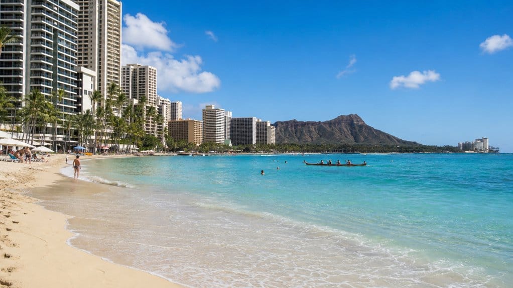
If you’re wondering where Waikiki sits in Hawaii, you’ll find it on Oʻahu’s south shore in Honolulu, pressed between the Pacific, the Ala Wai Canal, and Diamond Head’s green slope. You can step from hotel towers to warm sand in minutes, with surf rolling in and city buses humming nearby. It’s easy to reach from the airport, yet it feels like its own bright strip of shoreline. The exact edges get more interesting from there.
Key Takeaways
- Waikīkī is a neighborhood on Oʻahu’s south shore, within Honolulu in the City and County of Honolulu.
- It lies along the Pacific Ocean as a long coastal strip centered around Waikīkī Beach and Kalākaua Avenue.
- The Ala Wai Canal borders Waikīkī on the west and north sides.
- Diamond Head (Lēʻahi) marks Waikīkī’s eastern edge and is visible from the beach.
- Waikīkī’s approximate coordinates are 21.280693, -157.834549, about 6 to 8 miles from Honolulu International Airport.
Where Is Waikiki in Hawaii?
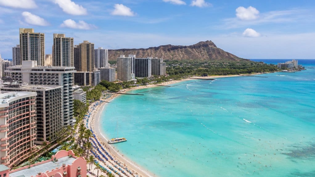
On the south shore of Honolulu, Waikīkī stretches across Oʻahu like Hawaii’s most famous beachside front porch. You’ll find it on the south shore of Oahu, tucked into Honolulu on the island of Oʻahu, with the Ala Wai Canal edging its west and north sides. Visitors staying here are also close to top swim areas along the shoreline.
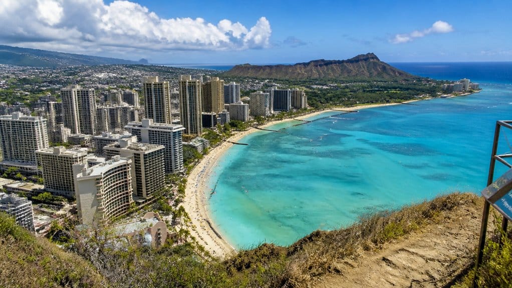
Head east and Diamond Head, also called Lēʻahi, marks Waikīkī’s dramatic boundary. Waikīkī is not a city but a Honolulu neighborhood within the City and County of Honolulu. The neighborhood sits at about 21.280693° N and -157.834549° W, if you like exact map pins. It covers roughly 3.4 square miles and uses ZIP code 96815. You’ll recognize it as Oʻahu’s main hotel and resort district, especially along Kalākaua Avenue, where palms sway, buses hiss to stops, and surfboards glide past like oversized postcards. Waikīkī is also known for its walkable spots, with beaches, food streets, and attractions clustered close together. If you’re aiming for classic Hawaii, you’re very much in the right spot.
Is Waikiki a Neighborhood or a City?
Here’s the simple answer: Waikīkī is a neighborhood, not its own city. When you visit, you’re in Honolulu on the island of Oʻahu, even if the famous name feels big enough to stand alone. In data and maps, Waikīkī appears under Neighborhoods, which tells you exactly how it fits. On a Honolulu map, Waikīkī is typically shown as one of the city’s key neighborhoods alongside other well-known areas.
That also matches the practical details you’d use on the ground. Waikīkī covers about 3.4 square miles, uses ZIP code 96815, and shares Honolulu’s 808 area code. Landmarks like Kalākaua Avenue, Waikīkī beach, and the resort zone all belong to the Waikīkī neighborhood inside Honolulu. Even its coordinates place it within the city region. So if you’re wondering whether Waikīkī is a city, the answer is no. It’s Honolulu’s best-known district, with surf, sidewalks, and plenty of sun. If you’re comparing where to stay on Oʻahu, Kailua, Ko Olina and the North Shore are other well-known areas alongside Waikīkī. Travelers often compare these districts based on vacation vibe, since different Oʻahu neighborhoods suit different kinds of stays.
Where Is Waikiki on Oʻahu’s Map?
At the south edge of Oʻahu, Waikīkī sits in Honolulu between the Ala Wai Canal and Diamond Head, with the Pacific rolling along its front door. When you look at an Oʻahu map, you’ll spot it on the Honolulu south shore, pressed between city streets and bright water.
You can picture Waikīkī as a long coastal strip rather than a hidden pocket. Kalākaua Avenue runs through its heart, linking hotels, beaches, shops, and that steady soundtrack of surf. The area is also easy to explore using Waikiki Trolley routes, which connect major sights and popular stops around Honolulu. To the east, Diamond Head gives you an easy landmark. To the west and north, the Ala Wai Canal helps define the neighborhood’s edge. It covers about 3.4 square miles, so you can cross key parts without epic planning. On a map, Waikīkī feels easy to find and even easier to remember. Many visitors use a Waikiki Beach map to spot the best places to swim, surf, and relax along this stretch of shore. Its shoreline is also known for soft sand and sunny beach spots that make this part of Honolulu especially inviting.
Still comparing USS Arizona Memorial?
Ask for tour ideas, hotel suggestions, or a simple trip plan that combines both.
Trip Helper
What Are Waikiki’s Exact Coordinates?
If you want Waikīkī’s exact spot, you can pin it at 21.280693° N and 157° 50′ 4.3764″ W on Oʻahu’s south shore in Honolulu. You’ll see how those coordinates place it neatly along the island’s map, where city streets meet the beach and the surf is never far off. Visitors also use Diamond Head shuttle options from Waikīkī when booking crater tours nearby. If you like the nuts and bolts, you can also track it in DMS as 21° 16′ 50.4948″ N, 157° 50′ 4.3764″ W, which sounds a bit like treasure-map math. From Waikīkī, popular landmarks like Diamond Head are close enough to reach by walk, bus, Uber, or tour. If you head there, the hike length and time can vary depending on your pace and trail conditions.
Waikīkī Latitude And Longitude
While Waikīkī feels easy to find once you see the curve of beach and the high-rise skyline, its exact coordinates are 21.280693, -157.834549. If you plug that latitude and longitude into your phone, you’ll land right in the Honolulu area, where Waikiki Beach meets busy streets, palms, and surf. Since Waikīkī is on Oahu, it also helps to know the island’s name and how to pronounce it correctly.
You can also read those numbers in DMS format as 21° 16 50.4948 N and 157° 50 4.3764 W. They point to the same spot, just in a different style. If you use projected mapping, Waikīkī sits at about Easting 620,902.22 and Northing 2,353,659.54. Diamond Head volcano also helps orient many visitors, since this landmark rises just east of Waikīkī on Oʻahu. That’s more technical, sure, but it helps surveyors and map tools stay precise. For you, these coordinates simply mean you can find Waikīkī fast, without wandering around like a distracted beachgoer. If you’re also heading downtown after the beach, knowing about State Capitol parking and entry can make a Honolulu stop a little smoother.
Map Position On Oʻahu
On Oʻahu’s south shore, Waikīkī sits in Honolulu as the island’s best-known beach neighborhood, tucked into ZIP code 96815 and easy to spot on any map of Hawaii. Honolulu itself is on Oʻahu, not a separate island, which helps place Waikīkī clearly on an Oʻahu map. You’ll find it on the South side of Oʻahu in the United States, near Ala Moana and the city’s busy shoreline. A quick look at an Oahu map also shows Waikīkī within the island’s south-shore region, alongside popular beaches and city neighborhoods.
- Decimal coordinates: 21.280693, -157.834549.
- DMS format: 21° 16′ 50.4948″ N, 157° 50′ 4.3764″ W.
- UTM position: Easting 620,902.22 and Northing 2,353,659.54.
- Map takeaway: you’re in Honolulu, not some secret cove.
If you plug those numbers into your phone, Waikīkī lands right where surfboards, hotel towers, and warm trade winds meet. It’s precise, practical, and still feels a little cinematic when the Pacific starts sparkling beside you at sunset.
What Borders Waikiki?
At the heart of Honolulu’s south shore, Waikīkī sits between clear natural markers that make it easy to picture. You can trace it from the Ala Wai Canal on the west and north toward Diamond Head (Lēʻahi) on the east, with the Pacific filling the southern edge in bright blue.
As you move around the neighborhood, the borders feel practical and scenic at once. The Ala Wai Harbor area and the canal define the side closest to Ala Moana, while the beachfront core runs along Kalākaua Avenue. Fort DeRussy Beach Park and Kapiʻolani Park help frame the coast with open lawns, palms, and easy public access. On the eastern side, the land gradually rises and Diamond Head (Lēʻahi) stands watch like a giant postcard that somehow never gets old at sunset. For a broader coastal perspective, the Ocean View Blue Line highlights how Waikīkī connects to some of Honolulu’s best seaside stops and views.
Where Is Waikiki Beach Relative to Diamond Head?
Just east of central Waikīkī, Diamond Head rises beyond the beach like a steady landmark you can’t really miss. From Waikīkī Beach, you’ll see Diamond Head anchoring the eastern end of the shoreline beside the Pacific Ocean. Waikīkī stretches toward it, with the resort strip along Kalākaua Avenue sitting just inland from that Diamond Head-facing coast. You’re practically below the crater in eastern Honolulu, so it feels like the neighborhood naturally points your eye that way. Many visitors also use Diamond Head reservations to plan a hike when exploring the area beyond Waikīkī Beach. For that hike, the best start window is usually between 6:00 am and 8:00 am for cooler temperatures and fewer crowds.
- You spot Diamond Head clearly from the sand and surf.
- Waikīkī Beach lines the south shore of Honolulu.
- Kalākaua Avenue stays close to the beachside action.
- Waikīkī’s position places it directly below Diamond Head.
It’s a simple orientation trick. If you’re facing the water, Diamond Head sits to your left, looking postcard-perfect and pleasantly impossible to ignore. For a different elevated view over Honolulu, some travelers take a quick route to Tantalus Lookout.
How Far Is Waikiki From Downtown Honolulu?
From downtown Honolulu, you can reach Waikīkī in about 15 to 20 minutes by car, though traffic likes to keep things interesting. You’ll head southeast along Honolulu’s busy coastline, with the Ala Wai area on one side and Diamond Head rising farther east. If you skip the car, you can still get there easily by bus or trolley, which makes the short hop feel simple. The city’s public transit also gives visitors a budget-friendly way to travel between downtown and Waikīkī. Visitors coming in from the airport also have several transportation options to reach Waikīkī. Travelers staying in the resort area can also book Waikiki hotel pickup tours around Oahu, making sightseeing easy without renting a car.
Distance And Drive Time
A drive between downtown Honolulu and Waikīkī usually takes about 30 minutes, so you can slip from the city’s historic core near Iolani Palace to the beachside buzz without much effort.
- You’re close enough for an easy city-to-surf switch.
- Waikīkī sits on Honolulu’s South Shore at 21.280693° N, -157.834549° W.
- The neighborhood stretches from the Ala Wai Canal toward Diamond Head.
- Kalākaua Avenue keeps hotels, restaurants, and sights tightly clustered.
That means your time in the car often feels shorter than expected. You can leave downtown, reach the surf, and hear palm fronds rattling by lunchtime. Visitors can also explore Historic Honolulu sights along the Waikiki Trolley Red Line while staying within this compact part of Oʻahu. Travelers who want a broader overview can also book hop-on hop-off bus tours around Oʻahu for easy sightseeing. If you plan a day beyond Honolulu, comparing Kualoa Ranch tours can help you choose between ATV, movie, and horseback experiences on Oʻahu. Waikīkī also puts you about 30 minutes from Pearl Harbor and Nuuanu Pali Lookout, which shows how compact Honolulu can feel. For visitors, that nearness makes planning simple and pleasantly flexible each day.
Route And Nearby Areas
On the route between downtown Honolulu and Waikīkī, you’ll watch the city trade stone landmarks for surfboards and shaded sidewalks in about 30 minutes. Start near Iolani Palace, then head southeast toward the south shore of Oʻahu. As you approach Waikīkī, the scene loosens up. Breezes carry salt, buses hum past beach gear shops, and hotel towers begin to edge the sand. If you’re riding TheBus, this trip between downtown Honolulu and Waikīkī is one of the simplest ways to get oriented without confusion.
For orientation, Waikīkī stretches from Ala Wai Harbor/Canal on the west to Diamond Head (Lēʻahi) on the east. If you’re staying nearby, you’ll likely spend time on Kalākaua Avenue, the main strip for hotels, dining, and shopping. It’s an easy base for exploring central Honolulu, and even Pearl Harbor sits within about 30 minutes, traffic willing. It’s also a convenient starting point for hotel pickup ocean trips if you want to explore Oʻahu without renting a car. That’s Oʻahu for you. If you’re planning a longer North Shore outing, Waimea Falls is another popular Oʻahu destination to map out from Waikīkī.
How Close Is Waikiki to Honolulu Airport?
Just a short ride separates Waikīkī from Honolulu’s main airport, which is one reason the neighborhood feels so easy to reach. If you land at Honolulu International Airport, you’re only about 6 to 8 miles from Waikīkī. That means you can go from runway buzz to beach views in roughly 15 to 25 minutes, depending on traffic. Many travelers arrange a private transfer with a lei greeting to make that arrival even smoother.
- You stay on Oʻahu, so transfers feel simple.
- Waikīkī’s hotel strip near Kalākaua Avenue is easy to access.
- Many airport routes connect you quickly to central stops.
- Located on the south side of the island, Waikīkī sits close enough to Honolulu that arrival feels almost effortless.
For a resort area known around the world, that convenience stands out. You’ll spend less time in transit and more time settling in. Travelers can also use a shared round-trip transfer between Honolulu Airport and Waikiki hotels or the cruise terminal for added convenience. Travelers can also book a return transfer from Waikiki hotels to Honolulu Airport for a smooth trip back at the end of their stay.
Why Waikiki’s South Shore Matters
When you look at Waikīkī’s south shore setting, you can see why this stretch of Honolulu became such a natural front door to the ocean. You’re right by the coast in front of Oʻahu’s big hotels and resorts, with beaches that pair calm lesson-friendly water in some spots with the clean outline of Lēʻahi on the horizon. That easy coastal access helped turn Waikīkī into an early tourism hub, and honestly, it’s hard to miss why. Oʻahu also has nearby green spaces like the Honolulu Botanical Gardens, a 650-acre collection spread across five unique garden settings for research, education, conservation, and public enjoyment. For visitors wanting to pair that oceanfront setting with deeper cultural context, Oʻahu also offers experiences like the Royal Aliʻi Lūʻau and Polynesian village traditions beyond the beach.
South Shore Setting
Along Oʻahu’s south shore, Waikīkī finds its sweet spot in Honolulu as a beachfront neighborhood built around the ocean. You see why fast. This beach district sits firmly on the island’s sunny side, where the Ala Wai Canal frames one edge and Diamond Head rises on the other. Landmarks like Moana Surfrider help you picture the setting.
- You’re in Honolulu, but the shoreline leads the show.
- High-rise hotels line the coast, with Mount Lahi views behind them.
- Waikīkī’s south-facing position made it Oʻahu’s main resort hub.
- Its coordinates, 21.280693° N and 157.834549° W, pin you squarely in this ocean-first zone.
From the sand, you hear surf, see towers, and feel how the neighborhood wraps itself around water. It’s geography with flip-flops on, basically.
Coastal Access Advantage
That south-shore position pays off the minute you step outside. In Waikīkī, you’re never far from warm Pacific water, soft sand, and the easy rhythm of the coast. Along Kalākaua Avenue, most hotels sit just two or three blocks from the ocean, and plenty are right on it.
That means you can stroll to Waikīkī Beach before breakfast, then wander toward Fort DeRussy or Duke Kahanamoku Beach without needing a car. Parts of the shoreline sit behind a rock reef, which helps create calmer, almost pool-like water. If you’re trying beginner surf or a first swim, that’s a real perk. Waikīkī’s compact stretch from the Ala Wai Canal to Diamond Head keeps beaches and parks close, so your day feels flexible, breezy, and wonderfully salt-splashed from start to finish.
What Attractions Are Near Waikiki?
Curious what sits just beyond Waikīkī’s famous shoreline? You’ve got easy access to wildlife, history, and waterfront fun within minutes. Start with these nearby picks:
- Honolulu Zoo sits about 0.5 miles away on 42 acres, where you can spot animals from 995 tropical species.
- Waikīkī Aquarium is 0.8 miles away on Kalākaua Avenue. Founded in 1904, it’s been run by the University of Hawaiʻi since 1919.
- Duke Kahanamoku Beach & Lagoon and Kahanamoku Lagoon lie about 1.9 miles away, where calm water and surf culture meet.
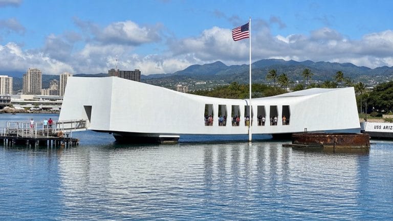
- Pearl Harbor and the USS Arizona Memorial sit about 12 miles away, usually within a half hour, and bring powerful World War II stories into focus.
You can also browse Honolulu Beach Walk, about 1.4 miles away, for crafts and casual stops.
Which Waikiki Areas Are Best to Stay In?
Where you stay in Waikīkī shapes the whole feel of your trip, from sunrise beach walks to late dinners under palm-lit streets. If you want the classic resort scene, stay along Kalākaua Avenue. You’ll be near major hotels, polished storefronts, and the ocean, usually just two or three blocks away.
For easy shopping and dining, choose the area around International Market Place and Royal Hawaiian Center. You can stroll to restaurants, cultural stops, and beach paths without much planning. If you prefer a quieter stretch, look closer to Kūhiō Beach Park or Queen’s Beach, where the sand feels calmer and mornings start softer. Traveling with family? Stay near Kapiʻolani Park or Fort DeRussy. You’ll keep Waikīkī Beach close, gain more breathing room, and still reach everything easily, flip-flops and all.
Frequently Asked Questions
How Did Waikiki Get Its Name?
Waikīkī got its name from Native Hawaiian meanings: “spouting fresh water.” You can trace its Historical name origins to springs and streams that shaped the area, while Early Waikiki settlers recognized those bubbling waters in daily life.
What Is the Best Time of Year to Visit Waikiki?
You’ll find the best time to visit Waikiki in April through early June, when trade winds cool things off. You’ll enjoy calmer seas, fewer crowds, local festivals, great sunsets, and even nearby whale watching opportunities.
Is Waikiki Safe for Tourists at Night?
Absolutely, Waikiki’s bustling like a million suns at night, and you’ll usually feel safe in busy, well-lit areas. Follow Nighttime safety tips, crime prevention basics, and use local emergency resources if you’re ever uneasy.
Can You Swim Year-Round in Waikiki?
Yes, you can swim year-round in Waikīkī thanks to warm water temperature and generally calm areas. You should still check Lifeguard coverage and beach safety daily, because waves, coral, and footing conditions can change quickly.
What Transportation Options Are Available Around Waikiki?
You’ve got Bus access, Honolulu transit, and rideshare options throughout Waikiki. You can also walk easily, hop trolley routes, or book boat tours. These choices let you reach beaches, shops, dining, and nearby sights without hassle.
Conclusion
Now you know exactly where Waikiki sits in Hawaii. You’ll find it on Oʻahu’s sunny south shore, tucked between Honolulu, Diamond Head, and the Pacific’s bright blue sweep. That location gives you easy airport access, walkable beaches, and a front-row seat to city energy and surf-side calm. You can hear waves, feel warm sand, and still reach shops and sights in minutes. Pretty convenient for a place that feels almost too postcard-perfect, right?