Oahu can feel as wide as a small world when you’re crossing from surfy west shores to cool green windward valleys. At its widest, you’re looking at about 30 miles north to south, yet the island keeps changing fast. You can leave Honolulu’s traffic, hear roosters in a misty valley, and reach a quiet beach before your playlist ends. That compact size hides a lot, and the numbers only get more interesting from here.
Key Takeaways
- Oʻahu is about 30 miles wide at its broadest north-to-south cross section.
- That width is an approximation, because the island’s curved shoreline and mountain ridges affect exact measurements.
- Oʻahu is longer east to west, stretching about 44 miles from Kaʻena Point to near Makapuʻu.
- The island covers roughly 597 square miles, so width alone does not describe its full size.
- Despite its compact width, varied terrain makes Oʻahu feel larger than the map suggests.
How Wide Is Oahu at Its Widest Point?
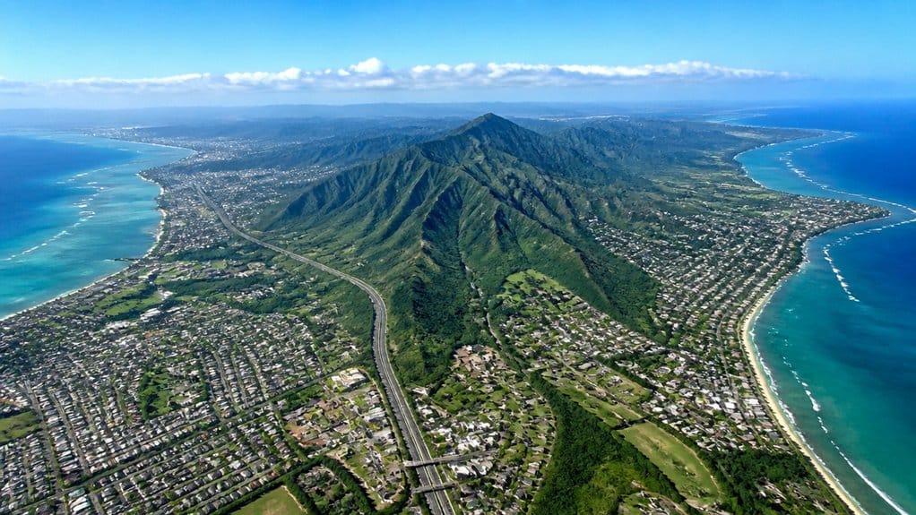
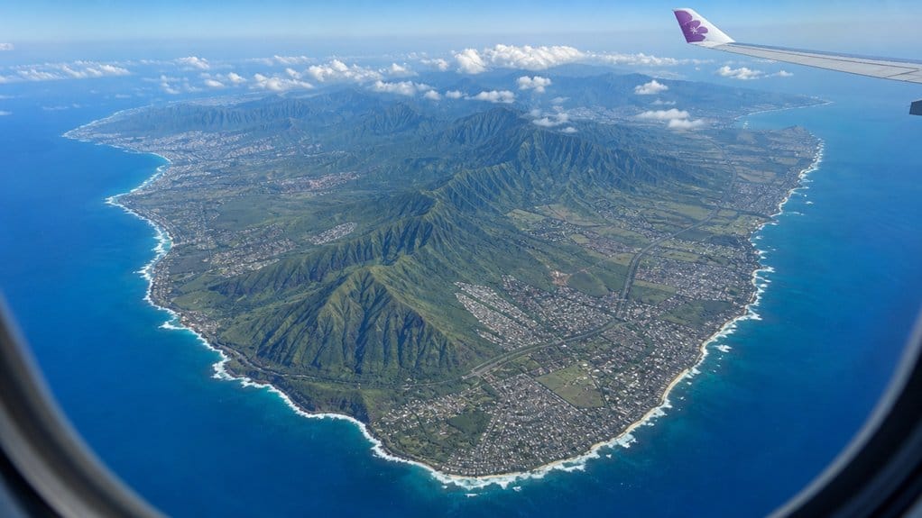
If you’re wondering how wide Oʻahu gets at its widest point, the short answer is about 30 miles from north to south. That figure gives you the island’s broadest cross section, not a perfect ruler-straight line. Oʻahu covers about 597 square miles overall, so width tells only part of the story. Its size and landscape help explain why Oʻahu can feel compact on a map yet varied as you travel across it.
When you look at a map, the exact number can shift a little. Shoreline curves, valleys, and the twin mountain ridges shape every measurement. If you drive between the Windward and Leeward sides, your route often feels close to that 30 miles. You’ll pass green cliffs, neighborhoods, and stretches of highway where trade winds hum through the car. It’s a practical width, easy to picture, even if the island refuses to be box-shaped.
How Long Is Oahu From End to End?
When you look at Oʻahu end to end, you’re measuring about 44 miles from Kaʻena Point in the west to the island’s eastern edge near Makapuʻu. That east-to-west reach feels longer when you drive it on the main highways, while the north-to-south span tops out closer to 30 miles. As you picture that shape, you can almost hear the trade winds crossing the central saddle between the Waiʻanae and Koʻolau ranges like they’ve got places to be. Oʻahu’s overall island area is about 597 square miles, giving those length and width measurements a broader sense of scale.
East-To-West Distance
From Kaʻena Point to Koko Head, Oʻahu runs about 44 miles from west to east, which means the island is longer end to end than many first-time visitors expect. If you picture Oʻahu as a quick beach hop, that number resets your sense of scale fast. The full span crosses the island’s broad central valley between the Waiʻanae and Koʻolau ranges, where open land gives the landscape a roomy feel.
If you drive the length on main roads, including H-1 and connecting highways, you’ll cover roughly the same 44 miles. That makes the geography easy to grasp from behind the wheel. For perspective, Oʻahu’s east-to-west reach is about twice New York City’s widest borough-to-borough span. Along the North Shore near Haleʻiwa, Aliʻi Beach Park adds surf watching and picnic spots to that cross-island sense of scale. Not bad for an island that still feels intimate when you explore.
North-To-South Span
Turn the map ninety degrees and Oʻahu still feels bigger than many visitors expect. From top to bottom, the island runs about 30 miles, so the north–south span is shorter than its 44-mile east-west reach. That contrast is part of Oahu’s size and shape, which makes the island feel compact on a map but varied in real travel time. You can cross much of that middle where the Waianae and Koolau ranges frame the central saddle, yet Honolulu still packs in beaches, traffic, and neighborhoods near the southeast.
| View | What you notice | Rough distance |
|---|---|---|
| Northern edge | Open country, surf, breezy roads | Start |
| Central saddle | Valleys, highways, tighter island width | About 30 miles |
| Southern shore | Honolulu, harbors, dense city life | End |
On a map, Oʻahu looks manageable. On the ground, 30 miles can still mean wet windward air, dry leeward slopes, and one more snack stop.
Still comparing Oahu Geography, Language, And Visitor Basics?
Ask for tour ideas, hotel suggestions, or a simple trip plan that combines both.
Trip Helper
How Big Is Oahu in Square Miles?
When you look at Oʻahu on a map, you’re looking at about 597 square miles of land, which gives the island a footprint that feels bigger than many visitors expect. You can also place it in context fast: Oʻahu is the third-largest of the main Hawaiian Islands by area, and it’s roughly twice the size of New York City. Understanding Oahu’s area in square miles helps explain why the island can feel both compact and surprisingly expansive. That means when you cross from busy Honolulu streets to quiet windward valleys, you’re covering a lot of island in one compact-looking package.
Total Square Mileage
At about 597 square miles, Oʻahu is bigger than many first-time visitors expect. When you look at a map, the island can seem compact. On the ground, those square miles stretch into long drives, changing shores, and whole mountain backdrops. You can cross about 44 miles east to west and roughly 30 miles north to south, yet the coastline runs about 227 miles. The island also hosts Honolulu, Hawaiʻi’s capital and main urban center.
| Measure | Approximate size | What you notice |
|---|---|---|
| Land area | 597 square miles | More room than you expect |
| East to west | 44 miles | A real day of exploring |
| North to south | 30 miles | Quick on paper, slower in traffic |
That means you don’t just visit Oʻahu. You move through it, from surf sounds to red dirt trails, with plenty still left unseen.
Size Ranking Context
Although Oʻahu can feel compact on a map, its roughly 597 square miles make it the third-largest of the main Hawaiian Islands by area. That ranking matters when you picture the island in real life. You can drive from surfy North Shore breaks to busy Honolulu streets, yet you’re still on one island with surprising room to roam.
Its Land Area sits in the 596.7–597 square miles range, or about 1,545 to 1,546 square kilometers. At about 44 miles long and 30 miles across, Oʻahu feels manageable, not tiny. You get nearly 227 miles of coastline too, so the shore seems to keep unfolding. Along that coastline and in warm lowland areas, you may also spot hau Hawaii, a native coastal plant associated with Oʻahu’s beach and shoreline landscapes. For scale, it’s about twice New York City’s size. No wonder the third largest island can feel both convenient and adventure-ready in a single weekend trip.
How Long Is Oahu’s Coastline?
Surprisingly, Oʻahu’s coastline can measure about 227 miles if you trace every bay, inlet, and tidal curve, though you’ll also see a shorter figure of roughly 112 miles in some sources.
That difference comes down to how you measure it. If you follow every bend in the coastline, including coves and tidal edges, Oʻahu stretches to 227 miles. If you use a simpler line around the island, the total shrinks. Both numbers show up in guidebooks and references, so you’re not imagining things.
For broader island dimensions, Oʻahu is often discussed in terms of its length in miles and kilometers as well as its width.
As you picture that shoreline, you can hop from Waikīkī’s busy surf to Diamond Head’s volcanic edge. You can trace Kāneʻohe Bay’s calmer waters, then head past Lanikai, the North Shore, and rugged Kaʻena Point. It’s one island, yet the coast keeps changing its mood with every turn.
Where Is Oahu in Hawaii?
Where exactly does Oʻahu sit in Hawaiʻi? You’ll find Oʻahu in the central Pacific Ocean, around 21°30′N and 158°00′W, right in the middle of the Hawaiian Island chain. It’s one of Hawaii’s main islands, and it feels like a crossroads surrounded by blue water and steady trade winds.
If you look around the map, Kauaʻi sits to the northwest across the Kauai Channel, while Molokaʻi lies to the southeast across the Kaiwi Channel. Honolulu anchors Oʻahu’s southeast coast, and you’ll also find the island at the heart of Honolulu County. While Honolulu is often recognized on maps, it is a city on Oʻahu rather than a separate island. From California, Oʻahu sits about 2,400 miles west. From Japan, it’s roughly 3,850 miles east. That helps you picture just how far out in the Pacific Ocean this busy island rests, and how central it feels today.
What Mountains Shape Oahu’s Size?
If you want to understand Oʻahu’s size, start with the two mountain ranges that frame the island like long, rugged walls. You can picture the Waiʻanae Range on the west and the Koʻolau Range on the east, running roughly parallel with a broad central valley between them. That gap helps give Oʻahu its width and shape.
These two Oahu mountain ranges also help explain why the island has such distinct windward and leeward landscapes. The Waiʻanae Range is older, rougher, and home to Kaʻala, the island’s highest point at just over 4,000 feet. On the other side, the Koʻolau Range rises in steep green ridges and cliff faces that define much of the eastern coast. Between them, the land opens into a wide saddle and low plains. Those spaces stretch Oʻahu to about 30 miles north to south and help set its roughly 44-mile east to west reach overall.
Why Does Oahu Feel Bigger Than It Is?
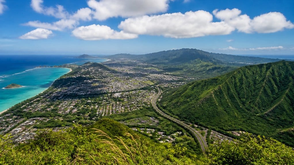
You can cross Oʻahu in under 45 miles, yet it feels much bigger when beaches, cliffs, rainforests, surf towns, and Diamond Head all crowd into one island. You notice it even more when traffic stacks up on H-1 or the Pali and a short drive starts acting like a road trip. Add the winding routes around valleys and ridges, and you get an island that keeps stretching time just enough to surprise you. A simple driving loop around Oʻahu can make the island’s regions, beaches, and scenic stops feel like a much longer journey.
Diverse Landscapes
Oʻahu feels like a shape-shifting island because its landscapes change fast and often. You can stand on Waikiki beach, then look inland and see mountain ranges rising like a backdrop painted overnight. Head toward Waianae or the Koʻolau side, and the island keeps switching moods.
- You move from sunny sand to misty ridges in under an hour.
- Windward valleys feel lush and cool, while leeward plains look dry and sunbaked.
- Urban Honolulu hums with people, but wide rural stretches suddenly feel open and far away.
- Sharp ridgelines, deep valleys, and a long jagged coast keep revealing new views.
That contrast makes Oʻahu seem bigger than its modest size. Even short outings give you rainforest air, surf noise, red dirt, and sweeping overlooks. The Tantalus area above Honolulu is another example, where a quick drive can trade city streets for cool forest views and panoramic lookouts.
Traffic And Travel Time
Often, the island feels bigger on the road than it does on a map. You can cross Oʻahu in theory within 44 miles east to west and about 30 north to south, yet traffic congestion stretches those numbers. Most people live around Honolulu, so your commute often funnels onto the H‑1, H‑2 and H‑3 freeways.
Mountains, the central plateau, and tight coastal corridors leave you with only a few practical routes. That means a 20 to 30 mile drive can easily top an hour at rush hour. Tour options can simplify some routes if you’d rather not drive or navigate bus schedules yourself. TheBus reaches nearly everywhere, but frequent stops make trips slower than driving. Add visitors heading to Waikīkī, Pearl Harbor, or the North Shore, and weekend lanes can crawl. On Oʻahu, distance isn’t just measured in miles. It’s measured in brake lights too.
Which Parts of Oahu Feel Largest?
Start in the middle of the island, and the widest feeling part of Oʻahu opens right up. You notice it first in the broad central plateau, where inland space stretches between the Waiʻanae and Koʻolau ranges and the island feels built sideways.
- In the southeast, Honolulu through Waikīkī to Ala Moana feels biggest because the city barely lets up.
- On the North Shore, the coast feels huge from Waimea Bay past Sunset Beach to Pipeline, with surf thunder and long empty sand.
- Along the Waianae Coast and Windward Coast, long shore roads make each corridor seem to keep going.
- Back inland, the open saddle gives you wide views, gentler slopes, and room to breathe.
Around Waikīkī, the mix of beach areas, food streets, and walkable stops can make the shoreline feel especially dense and lively.
Oʻahu isn’t just wide on a map. In the right places, it feels big in your bones.
How Long Does It Take to Drive Around Oahu?
How long does it really take to drive around the island? On Oʻahu, you can drive around the main loop in about 5.5 to 7 hours without long stops. Most travelers turn it into a full-day outing, though, because traffic and viewpoints tempt you. Honolulu and Waikīkī can easily tack on 30 to 90 minutes.
| Route style | Typical time |
|---|---|
| Nonstop loop | 5.5 to 7 hours |
| With light traffic | 6 to 8 hours |
| With major stops | 8 to 10 hours |
| Relaxed sightseeing day | 10 to 12 hours |
If you stop at Pearl Harbor, North Shore beaches, Kailua, or scenic lookouts, your drive around can stretch fast. Parking can also steal 15 to 45 minutes per stop. Pack snacks, start early, and let the road set pace. A practical Oahu circle drive works best when you plan it as an island road trip rather than a quick lap.
How Does Oahu Compare With Maui and Kauai?
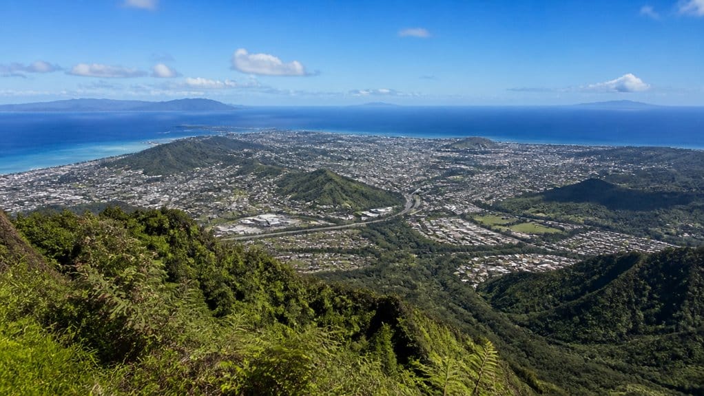
Think of Oʻahu as the compact middle ground in Hawaii’s island lineup. You can picture Oahu as smaller than Big Island and Maui, yet broader than Kauaʻi in overall feel. It stretches about 44 miles long and 30 miles across, packing 597 square miles into a tidy shape.
- Maui covers more land, about 727 square miles, but its shape feels longer and less compact.
- Kauaʻi is smaller at about 552 square miles and reaches roughly 33 miles at its widest.
- Oʻahu’s 227-mile coastline gives you more edge to trace than Kauaʻi, while Maui’s shoreline gets trickier to measure.
- You’ll also notice density fast. Oʻahu holds about 999,000 people, far more tightly packed than Maui or Kauaʻi. It feels busier, never boring.
Waikiki is on Oahu island, adding one of Hawaii’s most famous neighborhood names to this compact island’s map.
What Does Oahu’s Size Mean for Visitors?
Oʻahu’s size really works in your favor once you get around a bit. At about 44 miles long and 30 miles wide, Oʻahu feels manageable. You can cross much of the island in a few hours, traffic willing. That makes real day trips easy, not just hopeful plans on a map.
With 596.7–597 sq mi to explore, you get surprising variety in a compact space. One day, you might watch sunrise near Diamond Head, swim at Waikīkī, then chase bigger waves on the North Shore. Another day could mean Kāneʻohe Bay, lush ridges, and a plate lunch by the water. Choosing among areas like Waikīkī, Kailua, Ko Olina, and the North Shore can also shape your trip, since these best areas put different beaches, drives, and day trips within easier reach. The mountain ranges funnel roads along the coast, so drives can be slow but scenic. Give yourself extra time, and your 3 to 5 days will feel full, not frantic.
Frequently Asked Questions
How Many People Live on Oahu?
About 998,747 people live on Oʻahu as of 2024. You can gauge population density from nearly one million residents on 596.7 square miles. You’ll need demographic breakdown and housing statistics for deeper, current insight there.
What Is the Best Time of Year to Visit Oahu?
The absolute paradise time to visit Oʻahu is the best season of April to October; you’ll enjoy drier weather patterns. For fewer crowds and better prices, choose shoulder months April–May or September–October for ideal adventures.
Is Oahu a Good Island for First-Time Hawaii Visitors?
Yes, you’ll find Oʻahu excellent for first-time Hawaii visits, because you get easy logistics, budget travel options, rich cultural etiquette lessons, beginner hikes, famous beaches, historic sites, and enough variety to sample the islands confidently.
What Are Oahu’s Most Popular Beaches?
You’ll adore Oahu’s crowd-pleasers: Waikīkī for Surf lessons, Lanikai and Kailua for postcard sands, Hanauma Bay for snorkeling, and the North Shore for Turtle encounters and Sunset picnics, plus legendary waves at Pipeline, Sunset Beach, Waimea.
Do You Need a Rental Car on Oahu?
You don’t always need a rental car on Oʻahu. If you stay in Honolulu, use public transport, bike rentals, and rideshare apps. Rent one when you’ll explore North Shore, Windward beaches, or make multi-stop island days.
Conclusion
On Oahu, you can cross about 30 miles at its widest point, yet the island unfolds like a pocket-sized stage set with constant scene changes. You’ll hear city traffic in Honolulu, then trade winds in ironwoods, then surf pounding the North Shore. That compact size makes planning easy and discovery constant. You don’t need epic distances for variety here. You just need a full tank, good sandals, and a little curiosity to keep turning corners.